IMAGES TAKEN NEAR TO
Lynton Drive, ELY, CB6 1DQ
Introduction
This page details the photographs taken nearby to Lynton Drive, CB6 1DQ by members of the Geograph project.
The Geograph project started in 2005 with the aim of publishing, organising and preserving representative images for every square kilometre of Great Britain, Ireland and the Isle of Man.

There are currently over 7.5m images from over14,400 individuals and you can help contribute to the project by visiting https://www.geograph.org.uk
Image Map
Images are licensed for reuse under creativecommons.org/licenses/by-sa/2.0
Notes
- Clicking on the map will re-center to the selected point.
- The higher the marker number, the further away the image location is from the centre of the postcode.
Image Listing (19 Images Found)
Images are licensed for reuse under creativecommons.org/licenses/by-sa/2.0
Image
Details
Distance
1
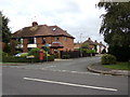
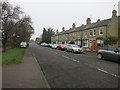
Lynton Drive, Ely
At the junction with Lynn Road & Buckingham Drive
Postbox No.CB6 7
Image: © Geographer
Taken: 11 Oct 2019
0.06 miles
2
Lynton Drive, Ely
At the junction with Lynn Road & Buckingham Drive
Postbox No.CB6 7
Image: © Geographer
Taken: 11 Oct 2019
0.06 miles
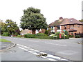
3
Lynn Road, Ely
At the junction with Lynton Drive & Buckingham Drive
Image: © Geographer
Taken: 11 Oct 2019
0.08 miles
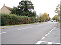
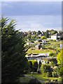
5
Lynn Road, Ely
Terraced yellow-brick houses in Ely.
Image: © Hugh Venables
Taken: 15 Nov 2014
0.12 miles
6
The Boundary of Turnpike Road
Marker beside Lynn Road at the junction with Cam Drive
Image: © Keith Edkins
Taken: 18 Oct 2007
0.13 miles
8
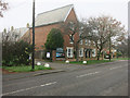
Ely Beet, Sports and Social Institute
With some new houses on Lynn Road, Ely.
Image: © Hugh Venables
Taken: 15 Nov 2014
0.15 miles
9
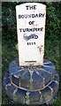
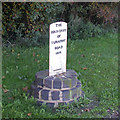
Old Boundary Marker by Lynn Road, Ely parish
Turnpike Terminus Marker by the UC road (was A10), in parish of Ely (East Cambridgeshire District), Ely, by roundabout at junction of Lynn Road with Cam Drive, on two circular courses of stone blocks set in grass.
Inscription reads:-
THE
BOUNDARY
OF
TURNPIKE
ROAD
1852
WILKINSON
ELY
Surveyed
Milestone Society National ID: CA_ELY01t
Image: © Milestone Society
Taken: Unknown
0.16 miles
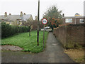
10
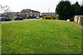
Space for dandelions by High Barns
This grass is an improvement on a former scruffy compound on the site.
Image: © Bill Boaden
Taken: 24 Apr 2015
0.17 miles