
IMAGES TAKEN NEAR TO
Russet Court, CAMBRIDGE, CB4 1FP
Introduction
This page details the photographs taken nearby to Russet Court, CB4 1FP by members of the Geograph project.
The Geograph project started in 2005 with the aim of publishing, organising and preserving representative images for every square kilometre of Great Britain, Ireland and the Isle of Man.

There are currently over 7.5m images from over14,400 individuals and you can help contribute to the project by visiting https://www.geograph.org.uk
Image Map
Images are licensed for reuse under creativecommons.org/licenses/by-sa/2.0
Notes
- Clicking on the map will re-center to the selected point.
- The higher the marker number, the further away the image location is from the centre of the postcode.
Image Listing (104 Images Found)
Images are licensed for reuse under creativecommons.org/licenses/by-sa/2.0
Image
Details
Distance
1
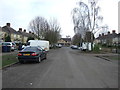
Cam Causeway, Cambridge
Looking south east.
Image: © JThomas
Taken: 18 Feb 2017
0.05 miles
3
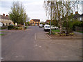
Cam Causeway, Cambridge
This unassuming residential street was built as part of the planned Cambridge ring road, which would have crossed the river and joined up with Wadloes Road and Barnwell Road in TL4759. The plans for this section of the ring road were eventually dropped and the land released for development. The house at the end of the street was evidently built fairly recently, much later than the rest of the street.
Image: © David Gruar
Taken: 29 Apr 2006
0.08 miles
4
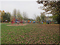
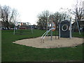
Children's play area, Chesterton
Not being used on a chilly November morning. Being metal doesn't make it any more encouraging but does mean that it isn't flammable, which is unfortunately important.
Image: © Hugh Venables
Taken: 12 Nov 2011
0.10 miles
6
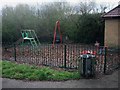
Small play area
On the edge of Bramblefields.
Image: © Hugh Venables
Taken: 21 Mar 2008
0.11 miles
7
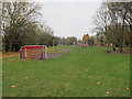
Play area, Chesterton
Extensive play area on a triangle of grass.
Image: © Hugh Venables
Taken: 12 Nov 2011
0.11 miles
8
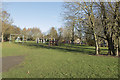
A children's play area
A small grassy area with a variety of activities for children of all ages. An interesting area for small children, larger climbing frames for older children and exercise machines for teenagers and adults.
Image: © Malcolm Neal
Taken: 2 Dec 2018
0.11 miles
9
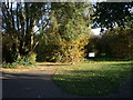
Entrance to Bramblefields local nature reserve
"At the turn of the 20th Century this region was fen and farmland. More recently it was used as allotments but these were abandoned after poor yields. Today Bramblefields provides an idyllic haven for wildlife and people in the midst of a residential area. Local Nature Reserve status has helped safeguard the site from future development and with it a commitment to protecting its wildlife and community value."-From the Welcome notice.
Image: © Keith Edkins
Taken: 6 Nov 2007
0.12 miles
10
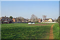
Chesterton: a green space
Between the back gardens of Lents Way (left) and Cheney Way (offstage right)
Image: © John Sutton
Taken: 23 Mar 2022
0.12 miles