
IMAGES TAKEN NEAR TO
The Missons, CAMBRIDGE, CB25 9TH
Introduction
This page details the photographs taken nearby to The Missons, CB25 9TH by members of the Geograph project.
The Geograph project started in 2005 with the aim of publishing, organising and preserving representative images for every square kilometre of Great Britain, Ireland and the Isle of Man.

There are currently over 7.5m images from over14,400 individuals and you can help contribute to the project by visiting https://www.geograph.org.uk
Image Map
Images are licensed for reuse under creativecommons.org/licenses/by-sa/2.0
Notes
- Clicking on the map will re-center to the selected point.
- The higher the marker number, the further away the image location is from the centre of the postcode.
Image Listing (41 Images Found)
Images are licensed for reuse under creativecommons.org/licenses/by-sa/2.0
Image
Details
Distance
1
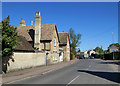
Waterbeach: on High Street in spring
May Day in a Fenland village.
Image: © John Sutton
Taken: 1 May 2018
0.05 miles
2

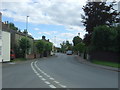
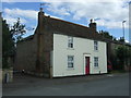
Wiles Cottage, High Street, Waterbeach
The cottage was built in the late 17th century and early 19th century. It was formerly the coachman's house to The Rookery. See Historic England website: https://historicengland.org.uk/listing/the-list/list-entry/1301879
Image: © Katie
Taken: 30 Nov 2018
0.06 miles
4
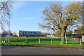
Waterbeach Primary School Christmas greetings
Looking from Way Lane towards Waterbeach Community Primary School on a sunny December morning.
Image: © John Sutton
Taken: 14 Dec 2020
0.08 miles
6
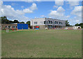
Waterbeach Community Primary School
A Sunday-morning view through the gates on Way Lane.
Image: © John Sutton
Taken: 28 Jun 2020
0.10 miles
7

Junction of Levitt Lane and Bannold Road in Waterbeach
Image: © Katie
Taken: 30 Nov 2018
0.10 miles
8
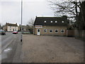
The Beach Fryer
Fish and chip shop in Waterbeach.
Image: © Hugh Venables
Taken: 18 Mar 2012
0.11 miles
9
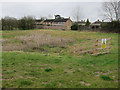
Drainage area by new housing
Damp area to take runoff from the new development Image
Image: © Hugh Venables
Taken: 18 Mar 2012
0.13 miles
10
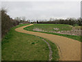
Path by new housing
Along the drainage area.
Image: © Hugh Venables
Taken: 18 Mar 2012
0.15 miles