
IMAGES TAKEN NEAR TO
Herrings Close, CAMBRIDGE, CB25 9AA
Introduction
This page details the photographs taken nearby to Herrings Close, CB25 9AA by members of the Geograph project.
The Geograph project started in 2005 with the aim of publishing, organising and preserving representative images for every square kilometre of Great Britain, Ireland and the Isle of Man.

There are currently over 7.5m images from over14,400 individuals and you can help contribute to the project by visiting https://www.geograph.org.uk
Image Map
Images are licensed for reuse under creativecommons.org/licenses/by-sa/2.0
Notes
- Clicking on the map will re-center to the selected point.
- The higher the marker number, the further away the image location is from the centre of the postcode.
Image Listing (81 Images Found)
Images are licensed for reuse under creativecommons.org/licenses/by-sa/2.0
Image
Details
Distance
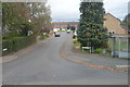
2
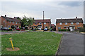
Stow-cum-Quy: Herring's Close
Council-built houses in a straggling village at the edge of The Fens, photographed early on a cloudy May afternoon.
Image: © John Sutton
Taken: 7 May 2019
0.03 miles
3
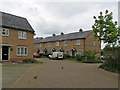
Stow-cum-Quy: a terrace and a brace of partridge
I did not notice as I framed this picture of a retro terrace on Vicarage Meadow that two red-legged partridge were scuttling into view.
Image: © John Sutton
Taken: 7 May 2019
0.04 miles
4
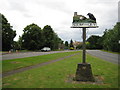
Stow cum Quy: Village sign
From a Geograph point of view the sign is right on the boundary with Image and Keith has uploaded an image Image of the sign in that grid square, but looking in the opposite direction. Curiously the giant jackdaw on this side is eyeing up the cattle in front of the church but on the other side the cattle have disappeared...
The road to the left is Main Street which used to be the B1102 while to the right is the current B1102 which bypasses the village.
Image: © Nigel Cox
Taken: 6 Jul 2008
0.07 miles
5
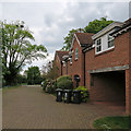
Stow-cum-Quy: Vicarage Meadow
Recent houses in a straggling village on the edge of The Fens, photographed on a cloudy May afternoon.
Image: © John Sutton
Taken: 7 May 2019
0.07 miles
6
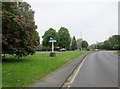
Village green and village name board Stow cum Quy
Name board to commemorate Silver Jubilee 1952-1977, Stow Road B1102
Image: © Martin Dawes
Taken: 19 May 2019
0.07 miles
7
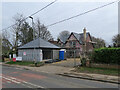
Stow-cum-Quy: building work on Stow Road
Image: © John Sutton
Taken: 6 Mar 2021
0.08 miles
8
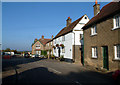
Main Street, Stow-cum-Quy CB5
On the right is the White Swan, painted white and dating back to the 18th century (possibly 17th); the unpainted brick building just beyond it also forms part of the pub.
Image: © Philip Talmage
Taken: 15 Oct 2005
0.12 miles
9
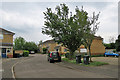
Stow-cum-Quy: Wheelwright Way and Minter Close
A cul-de-sac near the centre of a straggling village on the edge of the Cambridgeshire Fens.
Image: © John Sutton
Taken: 7 May 2019
0.12 miles
10
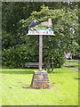
Stow cum Quy village sign
Plaque reads:
ERECTED BY THE VILLAGERS OF QUY TO COMMEMORATE THE SILVER JUBILEE OF QUEEN ELIZABETH II 1952 ~ 1977
Image: © Keith Edkins
Taken: 28 Jun 2007
0.13 miles