IMAGES TAKEN NEAR TO
Quarry Lane, CAMBRIDGE, CB25 0LU
Introduction
This page details the photographs taken nearby to Quarry Lane, CB25 0LU by members of the Geograph project.
The Geograph project started in 2005 with the aim of publishing, organising and preserving representative images for every square kilometre of Great Britain, Ireland and the Isle of Man.

There are currently over 7.5m images from over14,400 individuals and you can help contribute to the project by visiting https://www.geograph.org.uk
Image Map
Images are licensed for reuse under creativecommons.org/licenses/by-sa/2.0
Notes
- Clicking on the map will re-center to the selected point.
- The higher the marker number, the further away the image location is from the centre of the postcode.
Image Listing (135 Images Found)
Images are licensed for reuse under creativecommons.org/licenses/by-sa/2.0
Image
Details
Distance
1
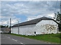
Swaffham Bulbeck: clunch outbuildings at Mitchell Lodge Farm
Restoration of buildings made of the local chalk building stone.
Image: © John Sutton
Taken: 20 Jun 2012
0.04 miles
3

Mitchell Hall, Swaffham Bulbeck
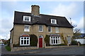
Mitchell Hall is the name of this fine grade II listed 16th century manor house on the corner of Quarry Lane and High Street. Full details are available at: http://www.eastcambs.gov.uk/html/LBDetails.asp?field1=461 . The name Swaffham Bulbeck derives from early possession by the de Bolebech family.
Image: © Stephen McKay
Taken: 17 Sep 2006
0.08 miles
4
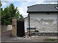
Swaffham Bulbeck: clunch wall on Quarry Lane
The outbuildings of Mitchell Lodge Farm (which are being restored - see Image]) have walls of the local chalk building stone.
Image: © John Sutton
Taken: 20 Jun 2012
0.08 miles
6
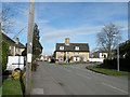
Swaffham Bulbeck, High Street 2009
Imitation of "Swaffham Bulbeck, High Street c1955" in the Frith collection http://www.francisfrith.com/search/england/cambridgeshire/swaffham+bulbeck/photos/swaffham+bulbeck_S678009.htm
Image: © Keith Edkins
Taken: 27 Feb 2009
0.09 miles
7
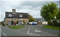
Road junction, Swaffham Bulbeck
The house has a massive chimney stack. It is older than it looks. It was a manor hall-house built probably in the 16C but altered and extended later in the 16C and 17C. The facade and gable were cased in yellow brick in the 19C. Timber-framed, with front wall and gable ends cased in gault brick. Steeply pitched, cement tile roofs with rebuilt ridge stack. (From the listing details).
Image: © Humphrey Bolton
Taken: 30 Sep 2018
0.10 miles
8
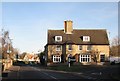
Swaffham Bulbeck: the corner of Quarry Lane
The 19th-century yellow-brick front of Mitchell Hall conceals a manor house dating from the 16th and 17th centuries - see http://www.britishlistedbuildings.co.uk/en-49443-mitchell-hall-swaffham-bulbeck .
Image: © John Sutton
Taken: 6 Jan 2012
0.10 miles
9
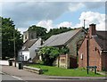
Swaffham Bulbeck: primary school, church tower and Vicarage Close
On High Street, the road to Bottisham.
Image: © John Sutton
Taken: 20 Jun 2012
0.10 miles