
IMAGES TAKEN NEAR TO
Burwell Road, CAMBRIDGE, CB25 0JH
Introduction
This page details the photographs taken nearby to Burwell Road, CB25 0JH by members of the Geograph project.
The Geograph project started in 2005 with the aim of publishing, organising and preserving representative images for every square kilometre of Great Britain, Ireland and the Isle of Man.

There are currently over 7.5m images from over14,400 individuals and you can help contribute to the project by visiting https://www.geograph.org.uk
Image Map
Images are licensed for reuse under creativecommons.org/licenses/by-sa/2.0
Notes
- Clicking on the map will re-center to the selected point.
- The higher the marker number, the further away the image location is from the centre of the postcode.
Image Listing (20 Images Found)
Images are licensed for reuse under creativecommons.org/licenses/by-sa/2.0
Image
Details
Distance
1
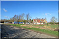
Reach: a new house on Burwell Road
On the eastern edge of a small fen-edge village.
Image: © John Sutton
Taken: 25 Feb 2022
0.03 miles
2
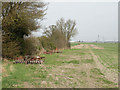
Field with abandoned equipment
The line continues with Image
Image: © Keith Edkins
Taken: 16 Mar 2009
0.04 miles
3
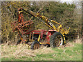
Abandoned Massey Ferguson tractor with Webb grab
The hydraulic Webb grab could be slewed through 360 degrees and was used to lift manure into muck spreaders, or sugar beet into a cleaner / loader mounted on the front of the tractor. The operator's precarious seat can be seen at the back.
An entertaining article on a novice's experience with the grab: http://www.ytmag.com/articles/artint205.htm
Image: © Keith Edkins
Taken: 16 Mar 2009
0.04 miles
4
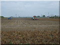
Potato harvest, Burwell Fen
North of Burwell Road, east of Reach.
Image: © JThomas
Taken: 15 Oct 2015
0.09 miles
6
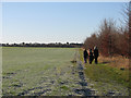
Reach: learning to ride on Earthworks Way
A permissive bridle way from Burwell Road to the Devil's Dyke (on the skyline), photographed a little after ten o'clock on a bright and frosty December morning.
Image: © John Sutton
Taken: 6 Dec 2014
0.12 miles
7
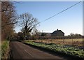
Reach: Burwell Road near Churchfield Farm
Shortly after ten o'clock on a bright and frosty December morning.
Image: © John Sutton
Taken: 6 Dec 2014
0.12 miles
8
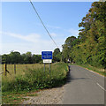
Reach: signs on Burwell Road
Official and unofficial signs on the edge of the village warn lorry drivers and caution all road users that hedgehogs cross here. The leaves are beginning to turn as autumn approaches.
Image: © John Sutton
Taken: 15 Sep 2020
0.12 miles
9
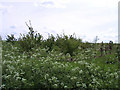
Reach Wood
Planted trees on the edge of Reach village.
Image: © Ajay Tegala
Taken: 5 May 2003
0.12 miles
10
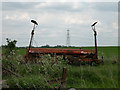
Abandoned Cultidrill
The stickers on this machine describe it as a Lely 400 Cultidrill. I presume this means it breaks up the topsoil and sows seed in a single pass. Or used to, anyway.
Image: © Keith Edkins
Taken: 1 May 2009
0.13 miles