IMAGES TAKEN NEAR TO
Mandeville, CAMBRIDGE, CB25 0AG
Introduction
This page details the photographs taken nearby to Mandeville, CB25 0AG by members of the Geograph project.
The Geograph project started in 2005 with the aim of publishing, organising and preserving representative images for every square kilometre of Great Britain, Ireland and the Isle of Man.

There are currently over 7.5m images from over14,400 individuals and you can help contribute to the project by visiting https://www.geograph.org.uk
Image Map
Images are licensed for reuse under creativecommons.org/licenses/by-sa/2.0
Notes
- Clicking on the map will re-center to the selected point.
- The higher the marker number, the further away the image location is from the centre of the postcode.
Image Listing (116 Images Found)
Images are licensed for reuse under creativecommons.org/licenses/by-sa/2.0
Image
Details
Distance
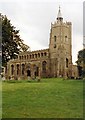
1
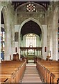
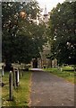
Burwell: the corner of Church Lane
A view towards St Mary's Church (in Image) on a December day of intense sunlight and deep shadow.
Image: © John Sutton
Taken: 6 Dec 2014
0.01 miles
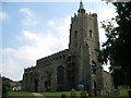
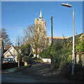
2
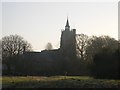
St Mary's Church
With part of the castle earthworks in the foreground.
Image: © Tony Lewis
Taken: 17 Dec 2007
0.02 miles
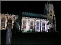
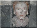
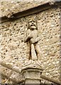
5
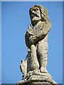
Woodwose: St Mary's church Burwell
Image: © Richard Greenwood
Taken: 30 Aug 2008
0.02 miles