
IMAGES TAKEN NEAR TO
Faulkner Close, CAMBRIDGE, CB24 6EF
Introduction
This page details the photographs taken nearby to Faulkner Close, CB24 6EF by members of the Geograph project.
The Geograph project started in 2005 with the aim of publishing, organising and preserving representative images for every square kilometre of Great Britain, Ireland and the Isle of Man.

There are currently over 7.5m images from over14,400 individuals and you can help contribute to the project by visiting https://www.geograph.org.uk
Image Map
Images are licensed for reuse under creativecommons.org/licenses/by-sa/2.0
Notes
- Clicking on the map will re-center to the selected point.
- The higher the marker number, the further away the image location is from the centre of the postcode.
Image Listing (43 Images Found)
Images are licensed for reuse under creativecommons.org/licenses/by-sa/2.0
Image
Details
Distance
1
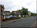
Houses in Butt Lane
Although Butt Lane is an old road, these houses are part of the major westward expansion of Milton village which has occurred since the bypass was built.
Image: © Keith Edkins
Taken: 30 May 2008
0.07 miles
2
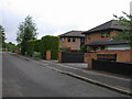
Coulson Close
Part of the major westward expansion of Milton village which has occurred since the bypass was built.
Image: © Keith Edkins
Taken: 30 May 2008
0.08 miles

5
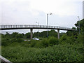
Butt Lane footbridge
Joining up, at least for pedestrians and cyclists, the two parts of the road severed by the Milton bypass in 1978.
Image: © Keith Edkins
Taken: 30 May 2008
0.10 miles
6
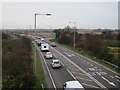
A10 to Cambridge
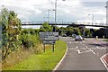
The 50mph speed limit is recent, with several stretches of A road reduced from derestricted (60mph) to 50mph this summer. The entrance/exit to the park and ride site is in the background. There is another entrance off Butt lane, which is also the route for turning right from Butt Lane onto the A10.
Image: © Hugh Venables
Taken: 24 Nov 2012
0.11 miles
7
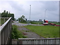
Old Butt Lane
Butt Lane was severed by the Miton Bypass ca. 1978. The old carriageway still exists, but has been first bollarded off, and then fenced off to stop cyclists and pedestrians attempting the direct crossing of the A10. They should use the bridge, whose ramp is just seen on the left.
Image: © Keith Edkins
Taken: 30 May 2008
0.11 miles
8
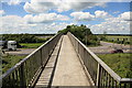
Bridge over the A10, Milton
Not the best designed bridge for crossing a very busy trunk road in an area where cycling is a highly popular mode of transport. The rails on either side are rather low, it is too narrow to allow pedestrians and cyclists to pass safely, and it contains right angle bends.
The junction of Butt Lane with the A10 can be seen on the right. The Milton Park and Ride site is in the distance on the left.
Image: © Rob Noble
Taken: 19 Jun 2012
0.11 miles
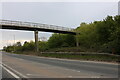
10
Butt Lane at the junction of Milton Road
Image: © David Howard
Taken: 5 Oct 2017
0.11 miles