IMAGES TAKEN NEAR TO
Hilton Street, CAMBRIDGE, CB24 5PU
Introduction
This page details the photographs taken nearby to Hilton Street, CB24 5PU by members of the Geograph project.
The Geograph project started in 2005 with the aim of publishing, organising and preserving representative images for every square kilometre of Great Britain, Ireland and the Isle of Man.

There are currently over 7.5m images from over14,400 individuals and you can help contribute to the project by visiting https://www.geograph.org.uk
Image Map
Images are licensed for reuse under creativecommons.org/licenses/by-sa/2.0
Notes
- Clicking on the map will re-center to the selected point.
- The higher the marker number, the further away the image location is from the centre of the postcode.
Image Listing (23 Images Found)
Images are licensed for reuse under creativecommons.org/licenses/by-sa/2.0
Image
Details
Distance

2
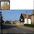
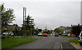
Poplar Farm Free House, Over CB4
Poplar Farm Free House, in The Lanes, is open only in the evenings, except Tuesdays (closed all day) and Sundays (open 12 noon - 3pm).
Image: © Philip Talmage
Taken: 15 Oct 2005
0.11 miles
3
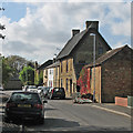
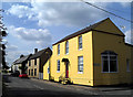
Over: Glover Street
The tall brick house, The Glover's House, dates from c 1730-40 and had an asbestos roof when it was Grade II listed in 1984 - see http://www.britishlistedbuildings.co.uk/en-50843-30-glover-street-over-cambridgeshire .
Image: © John Sutton
Taken: 10 Oct 2014
0.13 miles
7
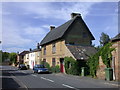
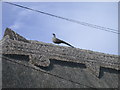
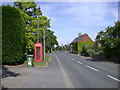
West Street, Over
Possibly of C17 origin but mainly C18. One bay to left hand may be timber framed, rendered but the rest is red and yellow gault brick "with corrugated iron roof originally thatched" - thus says the listed buildings register from 1984 but it seems to be all thatched now. LBS Number: 50865. http://www.heritagegateway.org.uk/Gateway/Results_Single.aspx?resourceID=5&uid=50865
See pheasant detail: Image
Image: © Keith Edkins
Taken: 30 Jul 2008
0.15 miles
9
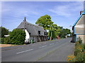
The Lanes 2012, Over
This is a similar scene to "The Lanes c1967, Over" in the Frith Collection http://www.francisfrith.com/over,cambridgeshire/photos/the-lanes-c1967_O114007/ . However there has been so much new development and plant growth in the intervening 45 years that I have not attempted to get an exact matching crop.
To see the two images together follow this http://www.geograph.org.uk/stuff/frith.php?id=2953098
Image: © Keith Edkins
Taken: 19 May 2012
0.15 miles
10
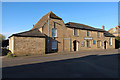
Over Baptist Church
Grade II listed, see https://historicengland.org.uk/listing/the-list/list-entry/1127310
Image: © Hugh Venables
Taken: 21 Mar 2020
0.16 miles