
IMAGES TAKEN NEAR TO
The Causeway, CAMBRIDGE, CB23 7EB
Introduction
This page details the photographs taken nearby to The Causeway, CB23 7EB by members of the Geograph project.
The Geograph project started in 2005 with the aim of publishing, organising and preserving representative images for every square kilometre of Great Britain, Ireland and the Isle of Man.

There are currently over 7.5m images from over14,400 individuals and you can help contribute to the project by visiting https://www.geograph.org.uk
Image Map
Images are licensed for reuse under creativecommons.org/licenses/by-sa/2.0
Notes
- Clicking on the map will re-center to the selected point.
- The higher the marker number, the further away the image location is from the centre of the postcode.
Image Listing (81 Images Found)
Images are licensed for reuse under creativecommons.org/licenses/by-sa/2.0
Image
Details
Distance
1
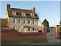
Church Farmhouse
The view of the house is not exactly improved by the insertion of the brick wall in the foreground - compare with http://www.geograph.org.uk/photo/2828159 - but one can understand the desire to separate the house grounds from the public footpath visible in the foreground.
The house dates from the early 18th century and is Listed Grade II. The hood over the doorway is original.
Image: © Alan Murray-Rust
Taken: 28 Dec 2014
0.00 miles
2
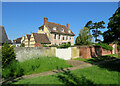
Comberton: Church Farmhouse on a summer morning
The red-brick wall on the right has been built since I took Image] in 2012. The handsome Grade II listed house dates from the eighteenth century.
Image: © John Sutton
Taken: 1 Jun 2021
0.01 miles
4
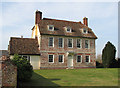
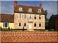
Church Farmhouse, Comberton
A handsome Grade II listed five-bay early eighteenth-century house next to the church. For more about it, see http://www.britishlistedbuildings.co.uk/en-51645-church-farmhouse-comberton .
Image: © John Sutton
Taken: 1 Mar 2012
0.01 miles
5
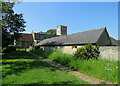
Comberton: Church Farm outbuildings and St Mary's
St Mary's Church is some way south of the village. Closer views of it include Alan Murray-Rust's Image] and my Image] and Image
Image: © John Sutton
Taken: 1 Jun 2021
0.02 miles
6
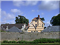
Church Farm House
Viewed, appropriately enough, from the churchyard
Image: © Keith Edkins
Taken: 10 Jul 2008
0.02 miles
7
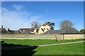
Comberton: Church Farm
Seen from the churchyard on a bright spring morning. For a closer look at the farmhouse, see Image], taken in 2012 before a new wall obscured some of that view.
Image: © John Sutton
Taken: 21 Mar 2020
0.03 miles
9
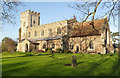
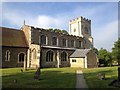
Church of St Mary, Comberton
Much restored in the 19th century. The nave is largely 14th to 16th century, the tower 14th century. The chancel was reconstructed in the 19th century but including original 13th and (on this side) 14th century windows. Listed Grade I.
Image: © Alan Murray-Rust
Taken: 28 Dec 2014
0.04 miles
