IMAGES TAKEN NEAR TO
Weston Woods, CAMBRIDGE, CB21 5NR
Introduction
This page details the photographs taken nearby to Weston Woods, CB21 5NR by members of the Geograph project.
The Geograph project started in 2005 with the aim of publishing, organising and preserving representative images for every square kilometre of Great Britain, Ireland and the Isle of Man.

There are currently over 7.5m images from over14,400 individuals and you can help contribute to the project by visiting https://www.geograph.org.uk
Image Map
Images are licensed for reuse under creativecommons.org/licenses/by-sa/2.0
Notes
- Clicking on the map will re-center to the selected point.
- The higher the marker number, the further away the image location is from the centre of the postcode.
Image Listing (9 Images Found)
Images are licensed for reuse under creativecommons.org/licenses/by-sa/2.0
Image
Details
Distance
2
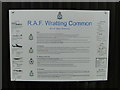
Information board at ex-RAF Wratting
Uploaded full size in the hope it is readable.
Image: © Adrian S Pye
Taken: 18 Mar 2015
0.07 miles
3
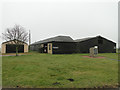
Ex-RAF buildings at what was RAF Wratting
A memorial stone sits in front of the buildings and can be seen here: http://www.geograph.org.uk/photo/4389703
Image: © Adrian S Pye
Taken: 18 Mar 2015
0.08 miles
4
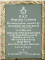
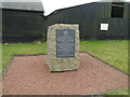
R.A.F. Wratting Common Memorial
R.A.F. Wratting Common memorial to the former airfield more info see http://www.raf.mod.uk/bombercommand/s51.html also see http://www.geograph.org.uk/photo/386827
Image: © Keith Evans
Taken: 3 Apr 2007
0.08 miles
5

Nissen Hut at RAF Wratting site
These semicircular structures were first designed to shelter troops in WW1. They were used extensively on RAF bases during and after WW2.
Image: © Bikeboy
Taken: 28 Jun 2014
0.08 miles
6

RAF Wratting Common Memorial
RAF Wratting Common opened 30th April 1943 as part of No.3 group Bomber Command. It finally closed in April 1946 and the land was turned back to farm use.
Image: © Bikeboy
Taken: 28 Jun 2014
0.08 miles
7
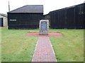
R.A.F. Wratting Common Memorial
R.A.F. Wratting Common memorial to the former airfield more info see http://www.raf.mod.uk/bombercommand/s51.html fore close up see http://www.geograph.org.uk/photo/386822
Image: © Keith Evans
Taken: 3 Apr 2007
0.09 miles
8
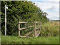
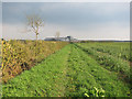
Public footpath, viewed from Common Road
Image: © Robert Edwards
Taken: 31 Jul 2009
0.09 miles