IMAGES TAKEN NEAR TO
Alington Terrace, CAMBRIDGE, CB21 4RF
Introduction
This page details the photographs taken nearby to Alington Terrace, CB21 4RF by members of the Geograph project.
The Geograph project started in 2005 with the aim of publishing, organising and preserving representative images for every square kilometre of Great Britain, Ireland and the Isle of Man.

There are currently over 7.5m images from over14,400 individuals and you can help contribute to the project by visiting https://www.geograph.org.uk
Image Map
Images are licensed for reuse under creativecommons.org/licenses/by-sa/2.0
Notes
- Clicking on the map will re-center to the selected point.
- The higher the marker number, the further away the image location is from the centre of the postcode.
Image Listing (6 Images Found)
Images are licensed for reuse under creativecommons.org/licenses/by-sa/2.0
Image
Details
Distance
1
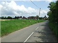
Horseheath Green
Horseheath Green looking east near to Cardinals Green, Cambridgeshire.
Image: © Keith Evans
Taken: 5 Jul 2012
0.02 miles
2
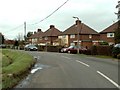
Houses along Horseheath Green
According to the O/S map these houses are known as Alington Cottages.
Image: © Robert Edwards
Taken: 4 Dec 2006
0.04 miles
3
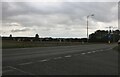
Horseheath Green at the junction of Park Hill
Image: © David Howard
Taken: 23 Aug 2020
0.06 miles
4
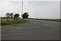
Horseheath Green at the junction of Park Hill
Image: © David Howard
Taken: 23 Aug 2020
0.07 miles
5

Footpath
Footpath near to Cardinals Green, Cambridgeshire.
Image: © Keith Evans
Taken: 5 Jul 2012
0.19 miles
6

Footpath Guide Post
Footpath guide post near to Cardinals Green, Cambridgeshire.
Image: © Keith Evans
Taken: 5 Jul 2012
0.20 miles