IMAGES TAKEN NEAR TO
London Road, CAMBRIDGE, CB21 4HH
Introduction
This page details the photographs taken nearby to London Road, CB21 4HH by members of the Geograph project.
The Geograph project started in 2005 with the aim of publishing, organising and preserving representative images for every square kilometre of Great Britain, Ireland and the Isle of Man.

There are currently over 7.5m images from over14,400 individuals and you can help contribute to the project by visiting https://www.geograph.org.uk
Image Map
Images are licensed for reuse under creativecommons.org/licenses/by-sa/2.0
Notes
- Clicking on the map will re-center to the selected point.
- The higher the marker number, the further away the image location is from the centre of the postcode.
Image Listing (8 Images Found)
Images are licensed for reuse under creativecommons.org/licenses/by-sa/2.0
Image
Details
Distance
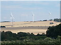
2
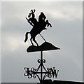
Weather vane at West Wratting Valley Farm
Image: © Keith Edkins
Taken: 16 Oct 2008
0.15 miles
3
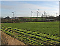
Near West Wratting Valley Farm
A view which has changed in recent years with the building of the Camgrain Advanced Processing Plant (left middle distance) and Wadlow Wind Farm. The picture shows five of the thirteen turbines.
Image: © John Sutton
Taken: 6 Dec 2013
0.15 miles
4
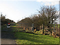
Restricted access
This metalled byway once ran to the A11, but since the main road was dualled, ends abruptly there and becomes an indistinct path to the Fleam Dyke footbridge, so it is not much used. The locked gate deters four-wheeled traffic. The poster opposes a wind farm planned for the hills to the east.
Image: © John Sutton
Taken: 28 Jan 2011
0.16 miles
5
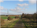
Little-used byway
This byway, from several villages east of Cambridge, stops abruptly at the A11 (behind the camera), where it becomes an indistinct footpath to Fleam Dyke footbridge. This view towards West Wratting Valley Farm shows Wilbraham Chalk Quarry in the distance. Beyond the quarry the byway crosses the hill to Lark Hall Corner.
Image: © John Sutton
Taken: 28 Jan 2011
0.16 miles
6
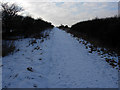
Bridleway from West Wratting Farm
Ends at the A11 so little used. Some deer prints in the snow.
Image: © Hugh Venables
Taken: 7 Feb 2009
0.18 miles
7
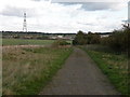
Bridleway towards West Wratting Valley Farm
Image: © Keith Edkins
Taken: 16 Oct 2008
0.25 miles