IMAGES TAKEN NEAR TO
Otter Burn, CB21 4AT
Introduction
This page details the photographs taken nearby to Otter Burn, CB21 4AT by members of the Geograph project.
The Geograph project started in 2005 with the aim of publishing, organising and preserving representative images for every square kilometre of Great Britain, Ireland and the Isle of Man.

There are currently over 7.5m images from over14,400 individuals and you can help contribute to the project by visiting https://www.geograph.org.uk
Image Map
Images are licensed for reuse under creativecommons.org/licenses/by-sa/2.0
Notes
- Clicking on the map will re-center to the selected point.
- The higher the marker number, the further away the image location is from the centre of the postcode.
Image Listing (19 Images Found)
Images are licensed for reuse under creativecommons.org/licenses/by-sa/2.0
Image
Details
Distance
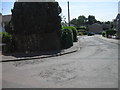
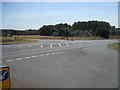
1
Road Junction
Road junction near to Linton, Cambridgeshire.
Image: © Keith Evans
Taken: 9 Oct 2014
0.10 miles
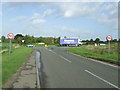
2
Bartlow Road Crossroads
The A1307 Cambridge-Haverhill road at the Bartlow Road crossroads. This photo was taken during a gap in the traffic. The photo Image shows this junction when it was in use by traffic.
Image: © M H Evans
Taken: 23 Sep 2011
0.11 miles
3
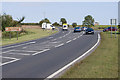
Bartlow Road Crossroads
The A1307 Cambridge-Haverhill road, at the Bartlow Road crossing. The traffic in this photo is moderately busy, with both side-roads carrying traffic to or from the main road. This contrasts with photo Image Many of the road junctions along this busy Cambridge-Haverhill road have been the sites of traffic accidents.
Image: © M H Evans
Taken: 23 Sep 2011
0.11 miles
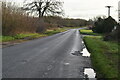
5
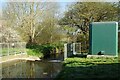
Linton Weir
Looking downstream on the Granta. The green box is an Environment Agency facility.
Image: © Glyn Baker
Taken: 7 Apr 2021
0.17 miles
6
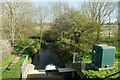
Downstream on the Granta
Taken from the A1307 bridge see also Image
Image: © Glyn Baker
Taken: 7 Apr 2021
0.17 miles
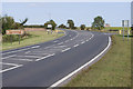
8
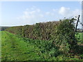
Hedge And Footpath
Hedge and footpath near to Linton, Cambridgeshire.
Image: © Keith Evans
Taken: 9 Oct 2014
0.20 miles