
IMAGES TAKEN NEAR TO
Rustat Avenue, CAMBRIDGE, CB1 3RF
Introduction
This page details the photographs taken nearby to Rustat Avenue, CB1 3RF by members of the Geograph project.
The Geograph project started in 2005 with the aim of publishing, organising and preserving representative images for every square kilometre of Great Britain, Ireland and the Isle of Man.

There are currently over 7.5m images from over14,400 individuals and you can help contribute to the project by visiting https://www.geograph.org.uk
Image Map
Images are licensed for reuse under creativecommons.org/licenses/by-sa/2.0
Notes
- Clicking on the map will re-center to the selected point.
- The higher the marker number, the further away the image location is from the centre of the postcode.
Image Listing (1472 Images Found)
Images are licensed for reuse under creativecommons.org/licenses/by-sa/2.0
Image
Details
Distance
1

A bin for all reasons
A colourful micro-recycling centre outside Adams House. Left to right they are designated:
Green: green glass bottles & jars
Black: newspapers, magazines & white paper
White: clear glass bottles & jars
Yellow: food & drink cans
Grey: glass bottles & jars
Image: © Keith Edkins
Taken: 18 Oct 2008
0.01 miles
3
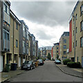
South along Rustat Avenue
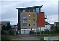
These blocks were built on industrial land east of the railway.
Image: © John Sutton
Taken: 9 Aug 2021
0.01 miles
4
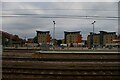
Cambridge station: looking east at new housing
Image: © Christopher Hilton
Taken: 9 Jul 2019
0.02 miles
6
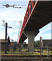
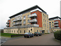
The Tony Carter Cycle Bridge
The safe and quick way to walk or cycle in to town from the south-east suburbs. Beyond the concrete pier, grass grows where there were, until quite recently, lots of sidings. The track in the foreground serves the carriage-washing plant - Image] .
Image: © John Sutton
Taken: 7 Oct 2010
0.03 miles
7
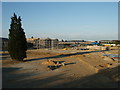
View of Rustat Ave taken 21/6/2003
View of Rustat Ave after Cambridge Instruments factory was demolished, but before houses were erected.
Image: © chris hayes
Taken: 21 Jun 2003
0.03 miles
8
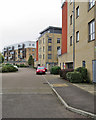
On Rustat Avenue
A housing development on brownfield land between the railway and Rustat Road.
Image: © John Sutton
Taken: 23 Oct 2017
0.03 miles
9
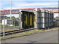
Cambridge Carriage Washing Plant
This shot, taken through the perimeter fence, is now an historical record as the plant was demolished recently. New sidings and electrical overhead are being put in where there were once goods sidings operated by diesel (and originally steam) engines. Image], taken from the cycle bridge, shows the plant and the former sidings from above. (The red-and-white chequer boards warn of limited clearance.)
Image: © John Sutton
Taken: 7 Oct 2010
0.03 miles
10
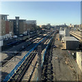
Cambridge's new carriage sidings
New sidings for the stabling and cleaning of Thameslink trains have taken shape over the last year - for an earlier stage of the project, see Image] (April 2019), which has links to other comparable images. The picture was taken through the dirty perspex of the Carter Cycle Bridge, so is less crisp than I would have liked.
Image: © John Sutton
Taken: 2 Oct 2019
0.03 miles