
IMAGES TAKEN NEAR TO
Argyle Street, CAMBRIDGE, CB1 3LS
Introduction
This page details the photographs taken nearby to Argyle Street, CB1 3LS by members of the Geograph project.
The Geograph project started in 2005 with the aim of publishing, organising and preserving representative images for every square kilometre of Great Britain, Ireland and the Isle of Man.

There are currently over 7.5m images from over14,400 individuals and you can help contribute to the project by visiting https://www.geograph.org.uk
Image Map
Images are licensed for reuse under creativecommons.org/licenses/by-sa/2.0
Notes
- Clicking on the map will re-center to the selected point.
- The higher the marker number, the further away the image location is from the centre of the postcode.
Image Listing (695 Images Found)
Images are licensed for reuse under creativecommons.org/licenses/by-sa/2.0
Image
Details
Distance
1
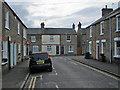
Hope Street and Argyle Street
Cambridge expanded eastwards in the decades after the coming of the railway in 1845.
Image: © John Sutton
Taken: 2 Jan 2020
0.00 miles
2
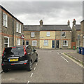
Yellow brick on Argyle Street
The Romsey district of Cambridge is a product of the railway age and near Cambridge Station. Romsey's yellow-brick terraces are a smoke-blackened yellow-grey, with the exception of those with cleaned frontages, like this one on Argyle Street.
Image: © John Sutton
Taken: 14 Jul 2023
0.00 miles
3
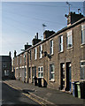
A November morning in Hope Street
The houses in this part of Cambridge were built after the coming of the railway.
Image: © John Sutton
Taken: 11 Nov 2016
0.02 miles
4
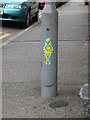
Primitive petroglyph, Hope Street
The precise significance of this image, discovered on a No Motor Vehicles sign, is unknown. Some authorities believe it portrays a demon receiving the heart of a sacrificial victim; others, pointing to its location on Hope Street, believe it indicates the hope that the spirit will ascend to a higher life. One archaeologist has even suggested it may be a design for a bottle opener.
Image: © Keith Edkins
Taken: 3 Feb 2008
0.03 miles
5
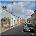
The end of Argyle Street
Houses of various styles and ages at the eastern end of Argyle Street in the Romsey Town district of Cambridge.
Image: © John Sutton
Taken: 9 Sep 2021
0.04 miles
6
Cockburn Street
Typical of the densely populated area around the station area.
Image: © Hugh Venables
Taken: 1 May 2010
0.04 miles
7
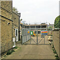
Hope Street Yard rebuilding
Set up in 1947 as a community of traders by Tony Dosanjh, Hope Street Yard housed a variety of independent businesses until a fire in January 2021. The site is now being redeveloped. For comparison: Image] (March 2021).
Image: © John Sutton
Taken: 23 Oct 2021
0.04 miles
8
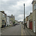
On Hope Street
The Romsey suburb of Cambridge on St Swithin's Day - overcast in the city and much of East Anglia, but it didn't rain.
Image: © John Sutton
Taken: 15 Jul 2021
0.05 miles
9
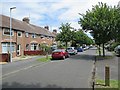
Greville Road
Suburban Cambridge on a summer afternoon.
Image: © John Sutton
Taken: 3 Jul 2014
0.05 miles
10
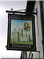
The Duke of Argyle - sign
The portrait resembles those of Field Marshall John Campbell, 2nd Duke of Argyll (as it is usually spelt elsewhere), 1st Duke of Greenwich, KG., who led the government army which defeated the Jacobites at Sheriffmuir in 1715. The building may be meant for his family seat, the first Inveraray Castle.
The pub is still boarded up (see Image and Image) - Punch Taverns are attempting to let a 5-year lease.
Image: © Keith Edkins
Taken: 6 Jul 2008
0.05 miles