IMAGES TAKEN NEAR TO
Fiske Close, SAFFRON WALDEN, CB10 2JJ

Introduction

This page details the photographs taken nearby to Fiske Close, CB10 2JJ by members of the Geograph project.

The Geograph project started in 2005 with the aim of publishing, organising and preserving representative images for every square kilometre of Great Britain, Ireland and the Isle of Man.

There are currently over 7.5m images from over14,400 individuals and you can help contribute to the project by visiting https://www.geograph.org.uk

Image Map


Images are licensed for reuse under creativecommons.org/licenses/by-sa/2.0
Notes
  • Clicking on the map will re-center to the selected point.
  • The higher the marker number, the further away the image location is from the centre of the postcode.

Image Listing (6 Images Found)

Images are licensed for reuse under creativecommons.org/licenses/by-sa/2.0
Image
Details
Distance
1
Ashdon Road, Saffron Walden
Image: © JThomas Taken: 31 Aug 2019
0.19 miles
2
Making your house stand out in De Vigier Avenue
Someone's decided to brighten up this rather drab road on the edge of Saffron Walden. David Hallam-Jones provided the following historical context to the name of the road. It is named after Swiss-born William de Vigier, who came to London in 1935 who invented the "Acrow prop". Apparently at first the old-fashioned builders preferred the established timber props, cut to fit for each job. However, the break for Vigier's adjustable props came when they were adopted by a few large builders, including McAlpines. By 1939, over 40,000 Acrow props were in use. Vigier’s company was named the Acrow Group, after his solicitor (Mr) A Crowe. Vigour adopted this name for his props as, like Kodak, it was an easily pronounceable neologism, with the additional advantage of appearing early in alphabetical lists. The nearby Ashdon Road Commercial Centre was formerly home to an Acrow factory.
Image: © Colin Bell Taken: 30 Mar 2008
0.20 miles
3
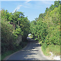
Saffron Walden: where the railway once crossed
A bridge once carried the Audley End to Bartlow branch line over Ashdon Road on the eastern edge of the town. One of the brick abutments is on the left and the embankments each side have been reclaimed by nature in the 59 years since the line closed. The Acrow factory was nearby, to the right beyond the railway, and in 1957 Acrow Halt, consisting of a concrete platform and waiting shelter, was opened to serve the plant. It was just north-east of the bridge and was built by Acrow and donated to British Railways on completion. The Disused Stations website has history and some fine photographs of Acrow Halt: http://disused-stations.org.uk/a/acrow_halt/index.shtml . The single fare from Saffron Walden to Acrow Halt was sixpence.
Image: © John Sutton Taken: 5 Sep 2023
0.21 miles
4
Houses on Ashdon Road, Saffron Walden
Image: © JThomas Taken: 31 Aug 2019
0.21 miles
5
New housing development on Ashdon Road
On aerial photos this is shown as agricultural land. It will be a new housing estate. There are concerns about the traffic that will be generated on to what is a main road with the characteristics of a country lane.
Image: © Alan Hawkes Taken: 18 Mar 2013
0.23 miles
6
Ashdon Road
Towards Saffron Walden.
Image: © JThomas Taken: 31 Aug 2019
0.24 miles