
IMAGES TAKEN NEAR TO
ALSTON, CA9 3DB
Introduction
This page details the photographs taken nearby to CA9 3DB by members of the Geograph project.
The Geograph project started in 2005 with the aim of publishing, organising and preserving representative images for every square kilometre of Great Britain, Ireland and the Isle of Man.

There are currently over 7.5m images from over14,400 individuals and you can help contribute to the project by visiting https://www.geograph.org.uk
Image Map
Images are licensed for reuse under creativecommons.org/licenses/by-sa/2.0
Notes
- Clicking on the map will re-center to the selected point.
- The higher the marker number, the further away the image location is from the centre of the postcode.
Image Listing (14 Images Found)
Images are licensed for reuse under creativecommons.org/licenses/by-sa/2.0
Image
Details
Distance
1
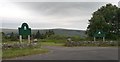
The entrance to Alston Moor Golf Club
Image: © Anthony Parkes
Taken: 29 Jun 2019
0.02 miles
2
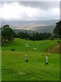
Alston Moor Golf Course
With fine views south west up Black Burn to Fiend's Fell.
Image: © Mick Garratt
Taken: 1 Oct 2005
0.06 miles
3
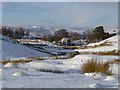
Rough pasture, Alston
Looking down towards Alston Moor Golf Club from the B6277 at Ricehead.
Image: © Andrew Smith
Taken: 27 Nov 2010
0.12 miles
4
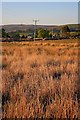
Electricity Transmission Poles
Viewed from High Plains and looking towards the golf club.
Image: © Mick Garratt
Taken: 30 Apr 2011
0.16 miles
5
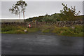
Georgian Letter Box
On the B6277 near Ricehead. http://www.geograph.org.uk/photo/4703618
Image: © Ian S
Taken: 7 Oct 2015
0.18 miles
6

Georgian Letter Box
On the B6277 near Ricehead. http://www.geograph.org.uk/photo/4703617
Image: © Ian S
Taken: 7 Oct 2015
0.18 miles
7
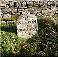
Old Milestone by the B6277, Alston Moor
Carved stone post by the B6277, in parish of ALSTON MOOR (EDEN District), by gate to Rise Head, on the verge right hand side of gate, 'GR' lamp letterbox in left hand side gate post, on East side of road. Alston stone, erected by the Alston turnpike trust in the 19th century.
Inscription reads:-
ALSTON
2
MIDDLETON
20
Carved benchmark on mid top front.
Grade II Listed. List Entry Number: 1144999
https://historicengland.org.uk/listing/the-list/list-entry/1144999
Milestone Society National ID: CU_ALMT02.
Image: © CF Smith
Taken: 9 Nov 2009
0.18 miles
8
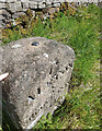
Old Milestone by the B6277, Alston Moor
Carved stone post by the B6277, in parish of ALSTON MOOR (EDEN District), by gate to Rise Head, on the verge right hand side of gate, 'GR' lamp letterbox in left hand side gate post, on East side of road. Alston stone, erected by the Alston turnpike trust in the 19th century. Environment Agency Rivet benchmark (flood control) on mid top representing 417.2m Above Sea Level which replaced an OS rivet.
Inscription reads: ALSTON / 2 / MIDDLETON / 20
Grade II Listed. List Entry Number: 1144999 https://historicengland.org.uk/listing/the-list/list-entry/1144999
Milestone Society National ID: CU_ALMT02.
Image: © Barbara Todd
Taken: 7 Sep 2023
0.18 miles
9
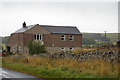
Buildings alongside the B6277
South of Alston.
Image: © Ian S
Taken: 7 Oct 2015
0.19 miles
10
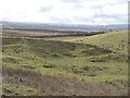
Old mine workings above High Plains Lodge
Seen from the Alston to Teesdale Road, high above South Tynedale.
Image: © Oliver Dixon
Taken: 20 Feb 2018
0.20 miles