IMAGES TAKEN NEAR TO
Gilsland, BRAMPTON, CA8 7BN
Introduction
This page details the photographs taken nearby to CA8 7BN by members of the Geograph project.
The Geograph project started in 2005 with the aim of publishing, organising and preserving representative images for every square kilometre of Great Britain, Ireland and the Isle of Man.

There are currently over 7.5m images from over14,400 individuals and you can help contribute to the project by visiting https://www.geograph.org.uk
Image Map
Images are licensed for reuse under creativecommons.org/licenses/by-sa/2.0
Notes
- Clicking on the map will re-center to the selected point.
- The higher the marker number, the further away the image location is from the centre of the postcode.
Image Listing (117 Images Found)
Images are licensed for reuse under creativecommons.org/licenses/by-sa/2.0
Image
Details
Distance
1

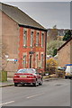
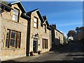
The B6318 through Gilsland
Nos 2-4 Railway Terrace is the white-painted building on the left
Image: © John Baker
Taken: 27 Mar 2012
0.03 miles
3
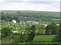
Gilsland
Photo taken from the minor road to Moscow in Image
Image: © Mike Quinn
Taken: 4 Jun 2008
0.05 miles
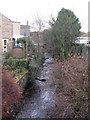
5
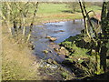
Confluence of the Poltross Burn and the River Irthing
Image: © Les Hull
Taken: 7 Apr 2010
0.07 miles
6
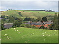
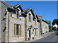
Gilsland village main street (2)
This part of the village is in Northumberland.
Image: © Mike Quinn
Taken: 27 Oct 2012
0.08 miles
7
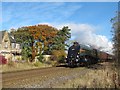
Streamlined Gresley A4 Pacific 60009 Union of South Africa passing the former Gilsland station
The locomotive is one of only six surviving Gresley A4s currently operational and certified for running on main lines. It's just possible to see the "Springbok" plaque on its boiler side. The loco had 14 boilers and five tenders up to withdrawal from British Railways service in 1966. It subsequently visited many preserved railways and hauled mainline steam specials. It was overhauled in 2007 and again, extensively, in 2010. More info on the Wiki entry http://en.wikipedia.org/wiki/LNER_Class_A4_4488_Union_of_South_Africa. There's a couple of recent video clips at http://www.youtube.com/watch?v=wXDWdhdbTBA.
Image: © Mike Quinn
Taken: 27 Oct 2012
0.08 miles
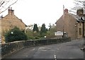
10
Poltross Burn, Gilsland
The Cumbria/Northumberland county boundary leaves the River Irthing (to the north, behind the photographer) and runs along Poltross Burn southwestwards towards the A69 in Image
Image: © Mike Quinn
Taken: 7 Dec 2007
0.08 miles