IMAGES TAKEN NEAR TO
West Hall, BRAMPTON, CA8 2ES
Introduction
This page details the photographs taken nearby to CA8 2ES by members of the Geograph project.
The Geograph project started in 2005 with the aim of publishing, organising and preserving representative images for every square kilometre of Great Britain, Ireland and the Isle of Man.

There are currently over 7.5m images from over14,400 individuals and you can help contribute to the project by visiting https://www.geograph.org.uk
Image Map
Images are licensed for reuse under creativecommons.org/licenses/by-sa/2.0
Notes
- Clicking on the map will re-center to the selected point.
- The higher the marker number, the further away the image location is from the centre of the postcode.
Image Listing (11 Images Found)
Images are licensed for reuse under creativecommons.org/licenses/by-sa/2.0
Image
Details
Distance
1
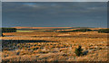
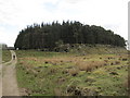
Highstead Ash
Highstead Ash seen from Waterhead Common.
Image: © Peter McDermott
Taken: 14 Jan 2012
0.01 miles
2

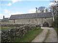
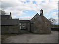
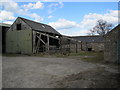
Converted barn at Highstead Ash
The barn appears to have been converted to residential use. The belfry is a bit of a mystery - possibly the building was originally a chapel.
Image: © Oliver Dixon
Taken: 20 Dec 2007
0.01 miles
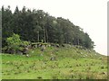
5
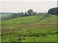
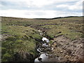
Rough pastures around Farmal Sike
Looking towards Highstead Ash.
Image: © Mike Quinn
Taken: 5 May 2011
0.05 miles