
IMAGES TAKEN NEAR TO
Farish Close, BRAMPTON, CA8 1EA
Introduction
This page details the photographs taken nearby to Farish Close, CA8 1EA by members of the Geograph project.
The Geograph project started in 2005 with the aim of publishing, organising and preserving representative images for every square kilometre of Great Britain, Ireland and the Isle of Man.

There are currently over 7.5m images from over14,400 individuals and you can help contribute to the project by visiting https://www.geograph.org.uk
Image Map
Images are licensed for reuse under creativecommons.org/licenses/by-sa/2.0
Notes
- Clicking on the map will re-center to the selected point.
- The higher the marker number, the further away the image location is from the centre of the postcode.
Image Listing (85 Images Found)
Images are licensed for reuse under creativecommons.org/licenses/by-sa/2.0
Image
Details
Distance
2
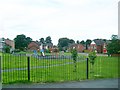
Play area
Modern private houses in the Irthing Park estate. On the left is the Brampton Community Centre.
Image: © Rose and Trev Clough
Taken: 16 Jul 2008
0.09 miles
3
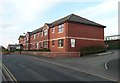
Union Court, Union Lane, Brampton
'Union' refers to the Poor Law Union, by which several parishes joined together to carry out their obligations under the Poor Law and erected what was popularly known as a workhouse on this site. The main building was behind, and was of a similar size to the present Junior School which now occupies the site. Union Court provides sheltered housing.
Image: © Humphrey Bolton
Taken: 29 Jan 2009
0.12 miles
4
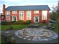
Community Centre off Union Lane, Brampton
The mosaic in the foreground is unfortunately disintegrating. The seat on right is what is known as a 'sociable'; two seats facing opposite directions but linked together.
Image: © Humphrey Bolton
Taken: 29 Jan 2009
0.16 miles
5
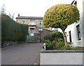
Falkins Hill, Brampton
The building in the centre of the view is named Prospect House, and was built in the 1830s It is shown as the Vicarage on the large scale OS map, but so is a house at the western end of Main Street near to the church.
Image: © Humphrey Bolton
Taken: 29 Jan 2009
0.17 miles
6
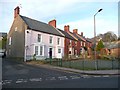
Oval House and Terrace, Brampton
Oval House has a 'bed and breakfast' sign. It looks as if all four houses were built about the same time. Although Oval House has a verge at each end of its roof, the chimney for the first of the three smaller houses rises from the party wall. The bay windows are all in the same style, although that of Oval House has been disguised by paint.
Image: © Humphrey Bolton
Taken: 29 Jan 2009
0.17 miles
8
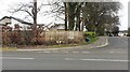
Junction of Longtown Road and Greenfield Lane
Ordnance Survey documents indicate that a benchmark levelled at 67.313m above Newlyn was verified in 1974 on a low wall at the apex of the bend near the hydrant sign. The wall is extant but in poor condition
Image: © Roger Templeman
Taken: 11 Feb 2023
0.19 miles
10
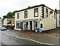
Newsagents 26 Main Street at Stephensons Lane junction
There is an Ordnance Survey benchmark Image on the narrow angled face of the shop
Image: © Roger Templeman
Taken: 31 May 2019
0.19 miles