
IMAGES TAKEN NEAR TO
High Street, WIGTON, CA7 9PY
Introduction
This page details the photographs taken nearby to High Street, CA7 9PY by members of the Geograph project.
The Geograph project started in 2005 with the aim of publishing, organising and preserving representative images for every square kilometre of Great Britain, Ireland and the Isle of Man.

There are currently over 7.5m images from over14,400 individuals and you can help contribute to the project by visiting https://www.geograph.org.uk
Image Map
Images are licensed for reuse under creativecommons.org/licenses/by-sa/2.0
Notes
- Clicking on the map will re-center to the selected point.
- The higher the marker number, the further away the image location is from the centre of the postcode.
Image Listing (100 Images Found)
Images are licensed for reuse under creativecommons.org/licenses/by-sa/2.0
Image
Details
Distance
1
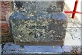
Benchmark on gatepost at entrance to house on South End (High Street)
Ordnance Survey cut mark benchmark levelled at 32.406m above Newlyn Datum verified in 1969
Image: © Luke Shaw
Taken: 23 Jul 2019
0.00 miles
2
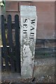
Old Boundary Marker
Parish Boundary Marker on South End in front of Flosh Cottage. Inscribed W.A.B.C. │ S.E.H. {both vertical}. The lettering is thought to indicate Wigton Above and Below the Cross and South End Hamlet. Grade II Listed https://historicengland.org.uk/listing/the-list/list-entry/1289251. See also http://www.geog.port.ac.uk/webmap/thelakes/photos/bnn87.jpg
Milestone Society National ID: CU_WIGT01pb
Image: © Roger Templeman
Taken: 24 Jul 2019
0.00 miles
3
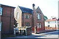
Detached house on west side of South End (B5304)
There is an Ordnance Survey benchmark Image at the base of the gatepost left of the metal gate
Image: © Luke Shaw
Taken: 23 Jul 2019
0.01 miles
4
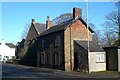
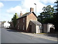
Tollhouse by the B5305, South End, Wigton
Tollhouse by the B5305, in the parish of Wigton (Allerdale District), Turnpike Keeper's House, South End, Wigton.
To be surveyed
Milestone Society National ID: CB.WIG02
Image: © Milestone Society
Taken: Unknown
0.01 miles
6
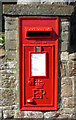
Elizabeth II postbox on South End, Wigton
Postbox No. CA7 207.
Image: © JThomas
Taken: 17 Sep 2016
0.02 miles
7
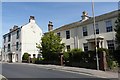
Houses, High Street Wigton
The property on the left, Number 87, will be demolished if construction of a new Tesco store on the site of Hopes Auction Mart http://www.geograph.org.uk/photo/2480544 goes ahead as planned.
On the right is Victoria Place, a pair of early 19th century houses (one now an office) which are Grade II listed http://www.imagesofengland.org.uk/details/default.aspx?id=72022 .
Image: © Rose and Trev Clough
Taken: 14 Jun 2011
0.06 miles
8
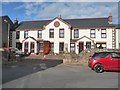
Armoury Cottages, George Street, Wigton
A World War One Drill Hall, converted to housing in 1992.
Image: © Christine Johnstone
Taken: 14 Oct 2014
0.06 miles
9
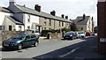
George Street, Wigton
These houses are in the centre of Wigton. Their condition in the 1970s bordered on unfit for human habitation. However, they were saved from condemnation by a change of approach in housing policy. Instead of being cleared, they were improved. They are now ideal low-cost homes, close to all amenities. Together with sympathetic modern infill development, they contribute variety to the streetscape of this interesting market town (birthplace of Melvyn Bragg).
See Wikipedia entry for Wigton: http://en.wikipedia.org/wiki/Wigton
Image: © John Fielding
Taken: 21 Jul 2010
0.06 miles
10
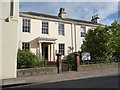
Victoria Place, High Street, Wigton
Grade 2 listed houses [now offices] on the east side of the road.
Image: © Christine Johnstone
Taken: 14 Oct 2014
0.06 miles