Old Boundary Marker
Introduction
The photograph on this page of Old Boundary Marker by Roger Templeman as part of the Geograph project.
The Geograph project started in 2005 with the aim of publishing, organising and preserving representative images for every square kilometre of Great Britain, Ireland and the Isle of Man.

There are currently over 7.5m images from over 14,400 individuals and you can help contribute to the project by visiting https://www.geograph.org.uk
Old Boundary Marker
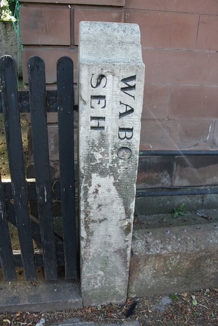
Image: © Roger Templeman Taken: 24 Jul 2019
Parish Boundary Marker on South End in front of Flosh Cottage. Inscribed W.A.B.C. │ S.E.H. {both vertical}. The lettering is thought to indicate Wigton Above and Below the Cross and South End Hamlet. Grade II Listed https://historicengland.org.uk/listing/the-list/list-entry/1289251. See also http://www.geog.port.ac.uk/webmap/thelakes/photos/bnn87.jpg Milestone Society National ID: CU_WIGT01pb
Images are licensed for reuse under creativecommons.org/licenses/by-sa/2.0
Image Location
Latitude
54.82161
Longitude
-3.159784