
IMAGES TAKEN NEAR TO
High Street, WIGTON, CA7 9PG
Introduction
This page details the photographs taken nearby to High Street, CA7 9PG by members of the Geograph project.
The Geograph project started in 2005 with the aim of publishing, organising and preserving representative images for every square kilometre of Great Britain, Ireland and the Isle of Man.

There are currently over 7.5m images from over14,400 individuals and you can help contribute to the project by visiting https://www.geograph.org.uk
Image Map
Images are licensed for reuse under creativecommons.org/licenses/by-sa/2.0
Notes
- Clicking on the map will re-center to the selected point.
- The higher the marker number, the further away the image location is from the centre of the postcode.
Image Listing (122 Images Found)
Images are licensed for reuse under creativecommons.org/licenses/by-sa/2.0
Image
Details
Distance
1
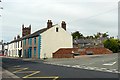
Wigton Memorial Garden
Seating area with raised flower beds, built around 2009. Situated off High Street, near the auction mart.
Apart from the name, we could not see a plaque to explain why this was here.
Image: © Rose and Trev Clough
Taken: 4 Jun 2011
0.01 miles
2
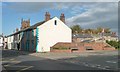
Wigton Memorial Garden
On the east side of High Street.
Image: © Christine Johnstone
Taken: 14 Oct 2014
0.01 miles
3
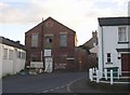
Old warehouse, Proctor Square, Wigton
Let's hope that this building will be restored.
Image: © Humphrey Bolton
Taken: 1 Nov 2006
0.01 miles
5
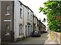
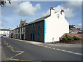
Proctors Row
A terrace of early 19th century cottages facing St. Mary's churchyard. The name derives from the Proctor's Office, which was in the row http://www.imagesofengland.org.uk/details/default.aspx?id=72044 .
Image: © Rose and Trev Clough
Taken: 4 Jun 2011
0.03 miles
6
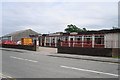
The Stocksman
Restaurant and bar adjacent to Image .
Image: © Rose and Trev Clough
Taken: 4 Jun 2011
0.03 miles
7
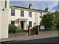
Victoria Place, High Street, Wigton
Grade 2 listed houses [now offices] on the east side of the road.
Image: © Christine Johnstone
Taken: 14 Oct 2014
0.03 miles
8
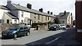
George Street, Wigton
These houses are in the centre of Wigton. Their condition in the 1970s bordered on unfit for human habitation. However, they were saved from condemnation by a change of approach in housing policy. Instead of being cleared, they were improved. They are now ideal low-cost homes, close to all amenities. Together with sympathetic modern infill development, they contribute variety to the streetscape of this interesting market town (birthplace of Melvyn Bragg).
See Wikipedia entry for Wigton: http://en.wikipedia.org/wiki/Wigton
Image: © John Fielding
Taken: 21 Jul 2010
0.03 miles
9
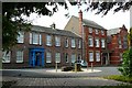
Thomlinson Junior School
The two-storey building on the left, Westmorland House, was originally a private residence, built around 1799 and extended in 1815. The taller building on the right was added in the late 19th century, when the Thomlinson Girls' Grammar School opened here. This merged with the nearby boys' school in the 1950s, to become the Nelson Thomlinson Grammar School. The Thomlinson Junior School moved here in 1968, after the secondary school vacated the site. For more information, see the school's website http://www.thomlinson.cumbria.sch.uk/index.php?category_id=103 .
Image: © Rose and Trev Clough
Taken: 4 Jun 2011
0.04 miles
10
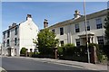
Houses, High Street Wigton
The property on the left, Number 87, will be demolished if construction of a new Tesco store on the site of Hopes Auction Mart http://www.geograph.org.uk/photo/2480544 goes ahead as planned.
On the right is Victoria Place, a pair of early 19th century houses (one now an office) which are Grade II listed http://www.imagesofengland.org.uk/details/default.aspx?id=72022 .
Image: © Rose and Trev Clough
Taken: 14 Jun 2011
0.04 miles