
IMAGES TAKEN NEAR TO
Hesket Newmarket, WIGTON, CA7 8JS
Introduction
This page details the photographs taken nearby to CA7 8JS by members of the Geograph project.
The Geograph project started in 2005 with the aim of publishing, organising and preserving representative images for every square kilometre of Great Britain, Ireland and the Isle of Man.

There are currently over 7.5m images from over14,400 individuals and you can help contribute to the project by visiting https://www.geograph.org.uk
Image Map
Images are licensed for reuse under creativecommons.org/licenses/by-sa/2.0
Notes
- Clicking on the map will re-center to the selected point.
- The higher the marker number, the further away the image location is from the centre of the postcode.
Image Listing (17 Images Found)
Images are licensed for reuse under creativecommons.org/licenses/by-sa/2.0
Image
Details
Distance
1
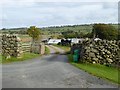
Stone Ends Farm
At the foot of Carrock Fell overlooking Mosedale Moss.
Image: © Oliver Dixon
Taken: 21 Oct 2016
0.02 miles
2
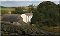
Stone Ends
Stone Ends Farm. For a wider perspective see Shaun Ferguson's picture Image
Image: © Peter McDermott
Taken: 4 Oct 2009
0.03 miles
3
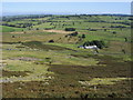
High on Rake Trod
High on Rake Trod looking down to Stone Ends Farm
Image: © Shaun Ferguson
Taken: 12 Sep 2009
0.03 miles
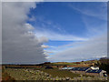
6
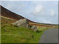
Rocks beside the road past Carrock Fell
Image: © Oliver Dixon
Taken: 21 Oct 2016
0.08 miles
7
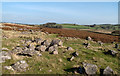
Boulders on moorland north of Mosedale
Mosedale is a hamlet on the eastern fringe of the Northern Fells of the Lake District, just north of it the road is unenclosed; there, these boulders lie at the roadside.
Image: © Trevor Littlewood
Taken: 28 Sep 2011
0.13 miles
8
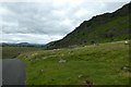
Near Further Gill Sike
Looking from the Mosedale road over the slopes of Carrock Fell.
Image: © DS Pugh
Taken: 11 Jul 2020
0.14 miles
9
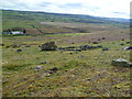
Fold under Carrock Fell
Rudimentary fold under Scurth
Image: © Michael Graham
Taken: 7 Apr 2012
0.18 miles
10
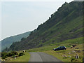
Apronful of Stones
The road to Mungrisdale on Caldbeck Commons with the slope of Carrock Fell rising.
Image: © Andrew Smith
Taken: 1 Jul 2006
0.18 miles