
IMAGES TAKEN NEAR TO
Irving Terrace, WIGTON, CA7 5DB
Introduction
This page details the photographs taken nearby to Irving Terrace, CA7 5DB by members of the Geograph project.
The Geograph project started in 2005 with the aim of publishing, organising and preserving representative images for every square kilometre of Great Britain, Ireland and the Isle of Man.

There are currently over 7.5m images from over14,400 individuals and you can help contribute to the project by visiting https://www.geograph.org.uk
Image Map
Images are licensed for reuse under creativecommons.org/licenses/by-sa/2.0
Notes
- Clicking on the map will re-center to the selected point.
- The higher the marker number, the further away the image location is from the centre of the postcode.
Image Listing (83 Images Found)
Images are licensed for reuse under creativecommons.org/licenses/by-sa/2.0
Image
Details
Distance
1
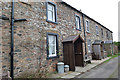
Houses in Port Carlisle
I am intrigued by the construction of these houses. There are few, if any, stones lying around, the whole are being mainly silt and sand. Were these stones part of Hadrian's Wall, which ran along here? If not, where did they come from? How did they avoid being used for previous buildings until the early 19th century?
Image: © Anne Burgess
Taken: 6 Feb 2017
0.01 miles
2
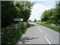
Entering Port Carlisle
Heading north west on National Cycle Route 72.
Image: © JThomas
Taken: 28 May 2016
0.02 miles
3
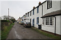
Field View
Field View is the name given to the back road behind the single main street of Port Carlisle.
Image: © Anne Burgess
Taken: 6 Feb 2017
0.02 miles
5
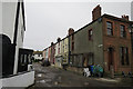
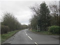
Scotch Street
This short street links the main street of Port Carlisle to Field View.
Image: © Anne Burgess
Taken: 6 Feb 2017
0.04 miles
7
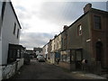
Scotch Street, Port Carlisle
Gives some indication of the urban ambitions with which Port Carlisle was born but which remained largely unrealised.
Image: © Jonathan Thacker
Taken: 26 Nov 2010
0.05 miles
8
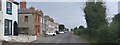
Port Carlisle
Port Carlisle which is more or less a single row of dwellings on the Solway coast.
Image: © Colin Kinnear
Taken: 9 Sep 2021
0.05 miles
9
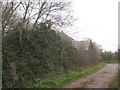
Track at the side of Solway Methodist church
Image: © Jonathan Thacker
Taken: 26 Nov 2010
0.06 miles
10
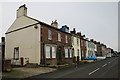
Port Carlisle
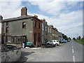
This is the west end of the main street of Port Carlisle, lined on one side only by substantial 19th century stone houses.
Image: © Anne Burgess
Taken: 6 Feb 2017
0.06 miles