
IMAGES TAKEN NEAR TO
Longcroft, Kirkbride, WIGTON, CA7 5BB
Introduction
This page details the photographs taken nearby to CA7 5BB by members of the Geograph project.
The Geograph project started in 2005 with the aim of publishing, organising and preserving representative images for every square kilometre of Great Britain, Ireland and the Isle of Man.

There are currently over 7.5m images from over14,400 individuals and you can help contribute to the project by visiting https://www.geograph.org.uk
Image Map
Images are licensed for reuse under creativecommons.org/licenses/by-sa/2.0
Notes
- Clicking on the map will re-center to the selected point.
- The higher the marker number, the further away the image location is from the centre of the postcode.
Image Listing (5 Images Found)
Images are licensed for reuse under creativecommons.org/licenses/by-sa/2.0
Image
Details
Distance
1
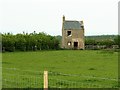
Derelict farm cottage
Back of the cottage, viewed across a field with plenty of rabbits in.
Image: © Rose and Trev Clough
Taken: 25 May 2008
0.12 miles
2
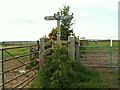
Signpost and gates
Taken at a right angled bend in a long farm track from Image to the RSPB's Rogersceugh Farm, 160m to the right.
The left arm indicates 3km to another RSPB farm, North Plain http://www.geograph.org.uk/photo/2151694 . The route through Campfield Marsh nature reserve is shown in a walk guide http://www.nationalparks.gov.uk/we/home/walk?walkid=625964 , which is useful because this end of the path is not marked on current OS maps.
Image: © Rose and Trev Clough
Taken: 25 May 2008
0.12 miles
3
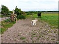
Cow and calves, Rogersceugh Farm
Taken from a footpath which runs through Campfield Marsh nature reserve http://www.rspb.org.uk/reserves/guide/c/campfieldmarsh/index.aspx . The far end of the field adjoins bog on Bowness Common.
Image: © Rose and Trev Clough
Taken: 25 May 2008
0.13 miles
4
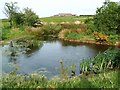
Pond near Rogersceugh Farm
The farm is on a drumlin (small hill formed by glacial activity) surrounded by peatlands. Rogersceugh is in the RSPB Campfield Marsh nature reserve http://www.rspb.org.uk/reserves/guide/c/campfieldmarsh/index.aspx .
Image: © Rose and Trev Clough
Taken: 25 May 2008
0.19 miles
5
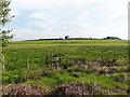
Public footpath to Rogersceugh
Some boards have been placed on the other side of the stile to help the walker over the wet ground.
Image: © Rose and Trev Clough
Taken: 25 May 2008
0.19 miles