IMAGES TAKEN NEAR TO
Beckfoot, Silloth, WIGTON, CA7 4LF
Introduction
This page details the photographs taken nearby to CA7 4LF by members of the Geograph project.
The Geograph project started in 2005 with the aim of publishing, organising and preserving representative images for every square kilometre of Great Britain, Ireland and the Isle of Man.

There are currently over 7.5m images from over14,400 individuals and you can help contribute to the project by visiting https://www.geograph.org.uk
Image Map
Images are licensed for reuse under creativecommons.org/licenses/by-sa/2.0
Notes
- Clicking on the map will re-center to the selected point.
- The higher the marker number, the further away the image location is from the centre of the postcode.
Image Listing (10 Images Found)
Images are licensed for reuse under creativecommons.org/licenses/by-sa/2.0
Image
Details
Distance
1
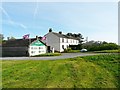
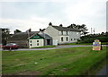
Entrance to Bank Mill Nurseries and Visitor Centre
Plant nursery with added attractions, including coffee shop, butterfly and reptile house, and nature reserve http://www.bankmillnurseries.co.uk/index.php .
Image: © Rose and Trev Clough
Taken: 24 Apr 2011
0.01 miles
3
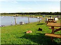
Wildlife pond and picnic area, Bank Mill Nurseries
Taken on Easter Sunday, so it was nice to see some bunnies.
Several species of indigenous and exotic waterfowl were at the pond, including barnacle geese (left).
For information see Bank Mill website http://www.bankmillnurseries.co.uk/nature.php .
Image: © Rose and Trev Clough
Taken: 24 Apr 2011
0.12 miles
5
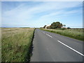
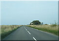
B5300, Mawbray Bank
Looking north east - direction Silloth.
Image: © JThomas
Taken: 17 Sep 2016
0.16 miles
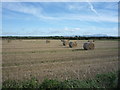
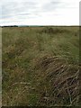
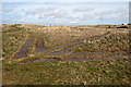
7
Mawbray Bank
Coastal grassland west of the B5300.
Image: © JThomas
Taken: 17 Sep 2016
0.21 miles
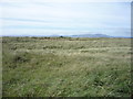
8
Mawbray Bank
Mawbray bank is an area of sand dunes and rough grassland stretching along the south shore of the Solway estuary. It is an AONB. This shot is taken looking roughly SE - Skiddaw is just visible on the horizon.
Image: © Nigel Monckton
Taken: 14 Oct 2005
0.22 miles
9
Mawbray bombing arrow WW2
This arrow was set into the dunes on Mawbray Bank during World War 2 to guide aircraft pilots into the targets set for them in the Solway Firth. Take a look here http://www.users.globalnet.co.uk/~rwbarnes/defence/ranges.htm#brg for more information.
Image: © Robert Matin
Taken: 4 May 2013
0.24 miles
10
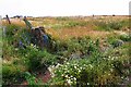
Gateway at farmland track east of Mawbray Bank
There is an Ordnance Survey benchmark Image on top of the stone gatepost
Image: © Luke Shaw
Taken: 16 Jul 2019
0.24 miles