
IMAGES TAKEN NEAR TO
Torpenhow, WIGTON, CA7 1HT
Introduction
This page details the photographs taken nearby to CA7 1HT by members of the Geograph project.
The Geograph project started in 2005 with the aim of publishing, organising and preserving representative images for every square kilometre of Great Britain, Ireland and the Isle of Man.

There are currently over 7.5m images from over14,400 individuals and you can help contribute to the project by visiting https://www.geograph.org.uk
Image Map
Images are licensed for reuse under creativecommons.org/licenses/by-sa/2.0
Notes
- Clicking on the map will re-center to the selected point.
- The higher the marker number, the further away the image location is from the centre of the postcode.
Image Listing (31 Images Found)
Images are licensed for reuse under creativecommons.org/licenses/by-sa/2.0
Image
Details
Distance
1
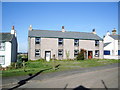
What was the Sun Inn, Torpenhow
Has been in the process of being converted into three houses for at least 5yrs. and they are still not finished
Image: © Alexander P Kapp
Taken: 4 Oct 2007
0.08 miles
2

Ordnance Survey Cut Mark
This mark can be found on the wall of St Michael's Church, Torpenhow.
The recorded details show a height of 138.5411 metres above sea level.
For more detail see : https://www.bench-marks.org.uk/bm242413
Image: © Peter Wood
Taken: 18 Mar 2025
0.10 miles
3
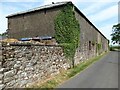
Farm Building, Torpenhow Hall
This long farm building adjoins Torpenhow Hall.
There is an Ordnance Survey flush bracket benchmark just above ground level on the wall at the corner of the building, beside the downspout (photograph Image).
Image: © Adrian Taylor
Taken: 24 Jul 2021
0.10 miles
4

Flush Bracket Benchmark, Torpenhow Hall
Detail of Ordnance Survey flush bracket benchmark number G3123 on the south west corner of a farm building at Torpenhow Hall. The benchmark marks a height of 135.4581m above mean sea level (Ordnance Datum Newlyn) last levelled in 1955 and verified in 1969 (location photograph Image).
Image: © Adrian Taylor
Taken: 24 Jul 2021
0.10 miles
5
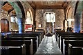
Torpenhow, St. Michael's Church: The nave from the chancel
Image: © Michael Garlick
Taken: 3 Aug 2019
0.10 miles
6
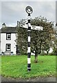
Direction Sign - Signpost at Torpenhow
Located on the northeast side of the junction in Torpenhow. Blennerhasset and Torpenhow parish. 3 arms and annulus finial.
Milestone Society National ID: CU_NY2039
Image: © B Todd
Taken: 10 Oct 2023
0.10 miles
7
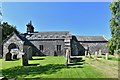
Torpenhow, St. Michael's Church: Southern aspect
Image: © Michael Garlick
Taken: 3 Aug 2019
0.10 miles
8
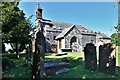
Torpenhow, St. Michael's Church: South western aspect
Image: © Michael Garlick
Taken: 3 Aug 2019
0.10 miles
9

Ordnance Survey Flush Bracket G3123
This bracket can be found on the roadside wall of a building at Torpenhow Hall.
The recorded details show a height of 135.4581 metres above sea level.
For more detail see : https://www.bench-marks.org.uk/bm13187
Image: © Peter Wood
Taken: 18 Mar 2025
0.11 miles
10
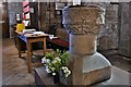
Torpenhow, St. Michael's Church: The font
Image: © Michael Garlick
Taken: 3 Aug 2019
0.11 miles