
IMAGES TAKEN NEAR TO
Honeypot Meadow, CARLISLE, CA6 4BF
Introduction
This page details the photographs taken nearby to Honeypot Meadow, CA6 4BF by members of the Geograph project.
The Geograph project started in 2005 with the aim of publishing, organising and preserving representative images for every square kilometre of Great Britain, Ireland and the Isle of Man.

There are currently over 7.5m images from over14,400 individuals and you can help contribute to the project by visiting https://www.geograph.org.uk
Image Map
Images are licensed for reuse under creativecommons.org/licenses/by-sa/2.0
Notes
- Clicking on the map will re-center to the selected point.
- The higher the marker number, the further away the image location is from the centre of the postcode.
Image Listing (9 Images Found)
Images are licensed for reuse under creativecommons.org/licenses/by-sa/2.0
Image
Details
Distance
1
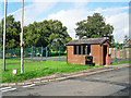
Bus shelter at Cargo
There used to be a regular, if infrequent, bus service from this stop but it ceased after council subsidies were withdrawn in 2014. A 'Village Wheels' minibus service http://www.cumbria.gov.uk/roads-transport/public-transport-road-safety/transport/commtrans/ruralwheels.asp now runs two trips a week to Carlisle, but must be booked in advance.
Image: © Rose and Trev Clough
Taken: 31 Aug 2016
0.13 miles
2
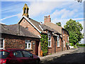
The Old School, Cargo
Now a house. The school and attached master's house were rebuilt in 1897, replacing the original school which opened in 1854 (Bulmer's Directory 1901, courtesy of Steve Bulman http://www.stevebulman.f9.co.uk/cumbria/1901/stanwix.html )
Image: © Rose and Trev Clough
Taken: 31 Aug 2016
0.13 miles
4
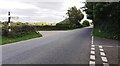
T-junction at Cargo
There is a Cumberland County Council finger signpost Image on the verge on the left hand side of the road
Image: © Roger Templeman
Taken: 17 Aug 2021
0.19 miles
5
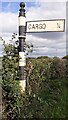
Cumberland County Council signpost
The signpost has Milestone Society National ID: CU_NY3659
Image: © Roger Templeman
Taken: 17 Aug 2021
0.20 miles
6

Benchmark on stone post on NE side of road at St Owens junction
Ordnance Survey cut mark benchmark leveelled at 14.962m above Newlyn Datum verified 1974
Image: © Roger Templeman
Taken: 17 Aug 2021
0.20 miles
7
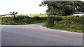
Road junction at St Owens sign
There is an Ordnance Survey benchmark Image on the gatepost in the hedge at the right hand corner of the junction. The mark at the base of the stone in a white patch of lichen
Image: © Roger Templeman
Taken: 17 Aug 2021
0.22 miles
9
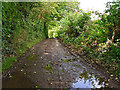
Track to the River Eden
A sign on a wall at the start of this track says 'Public Byroad - Riverside'.
Image: © Rose and Trev Clough
Taken: 31 Aug 2016
0.24 miles