IMAGES TAKEN NEAR TO
Armathwaite, CARLISLE, CA4 9PD

Introduction

This page details the photographs taken nearby to CA4 9PD by members of the Geograph project.

The Geograph project started in 2005 with the aim of publishing, organising and preserving representative images for every square kilometre of Great Britain, Ireland and the Isle of Man.

There are currently over 7.5m images from over14,400 individuals and you can help contribute to the project by visiting https://www.geograph.org.uk

Image Map


Images are licensed for reuse under creativecommons.org/licenses/by-sa/2.0
Notes
  • Clicking on the map will re-center to the selected point.
  • The higher the marker number, the further away the image location is from the centre of the postcode.

Image Listing (85 Images Found)

Images are licensed for reuse under creativecommons.org/licenses/by-sa/2.0
  • ...
Image
Details
Distance
1
Armathwaite Castle
View from Armathwaite Bridge looking up the River Eden to Armathwaite Castle.
Image: © Peter McDermott Taken: 4 Sep 2011
0.00 miles
2
Armathwaite Castle
The castle is a four-storey pele tower by the River Eden, adapted into a country house in 1752 - see http://www.visitcumbria.com/pen/armathwaite.htm. Photo taken from Armathwaite Bridge in NY5046.
Image: © Mike Quinn Taken: 14 Oct 2011
0.02 miles
3
River Eden View
Looking upstream on a disappointingly dull spring morning with a very low water level.
Image: © Mary and Angus Hogg Taken: 29 May 2019
0.04 miles
4
Riverside path, Armathwaite
Image: © David Brown Taken: 13 Oct 2015
0.06 miles
5
The Duke's Head Inn, Armathwaite
Opposite it two houses, according to the modern OS map, but look to have been a block of four originally.
Image: © Humphrey Bolton Taken: 27 Jan 2009
0.08 miles
6
Low Flats footpath
Despite fierce signs warning that the public footpath passes through ornamental gardens, that dogs should be kept on leads and that county council waymarking should be followed at all times, there proved to be a complete absence of waymarking, no gardens and all the dogs we met were free to roam (except mine - have to keep her out of the photo somehow...) which begs the question of why they bother with the sign unless the owners see merit in appearing gratuitously officious. Seems likely to be counter-productive to me.
Image: © Andy Waddington Taken: 28 Oct 2020
0.09 miles
7
Benchmark on #5 The Barn, Front Street
Ordnance Survey cut mark benchmark described on the Bench Mark Database at http://www.bench-marks.org.uk/bm43420
Image: © Roger Templeman Taken: 16 Jun 2012
0.09 miles
8
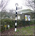
Guide Post, Armathwaite
Many of these old guide posts are neglected and rusty, but this one has a fresh coat of paint. Notice how the lettering 'Cumberland County Council' down the post is white in the black stripes and black in the white stripes.
Image: © Humphrey Bolton Taken: 27 Jan 2009
0.09 miles
9
Letter box next to the post office, Armathwaite
This looks quite old, so I think E R must be Edward VII.
Image: © Humphrey Bolton Taken: 27 Jan 2009
0.09 miles
10
Post Office, Armathwaite
For a close-up of the letter box see Image
Image: © Humphrey Bolton Taken: 27 Jan 2009
0.09 miles
  • ...