IMAGES TAKEN NEAR TO
Corby Hill, CARLISLE, CA4 8QB
Introduction
This page details the photographs taken nearby to CA4 8QB by members of the Geograph project.
The Geograph project started in 2005 with the aim of publishing, organising and preserving representative images for every square kilometre of Great Britain, Ireland and the Isle of Man.

There are currently over 7.5m images from over14,400 individuals and you can help contribute to the project by visiting https://www.geograph.org.uk
Image Map
Images are licensed for reuse under creativecommons.org/licenses/by-sa/2.0
Notes
- Clicking on the map will re-center to the selected point.
- The higher the marker number, the further away the image location is from the centre of the postcode.
Image Listing (13 Images Found)
Images are licensed for reuse under creativecommons.org/licenses/by-sa/2.0
Image
Details
Distance
1
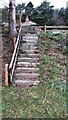
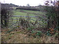
Steps from NW side of A69 to Carlisle Lodge
Image: © Luke Shaw
Taken: 22 Dec 2022
0.01 miles
4
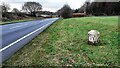
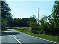
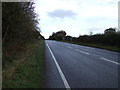
A69 heading towards Carlisle near Greenholme
There is a milestone Image on the right hand verge
Image: © Roger Templeman
Taken: 22 Dec 2022
0.05 miles
6
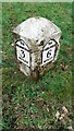
Milestone, Brampton 3, Carlisle 6 miles, on NW side of A69 SW of Low Moor
Image: © Roger Templeman
Taken: 22 Dec 2022
0.10 miles
7
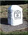
Old Milestone by the A69, north east of Warwick bridge
Metal plates attached to stone post by the A69, in parish of HAYTON (CARLISLE District), Greenholme, East of Carlisle Lodge, on grass verge, on North side of road. Carlisle plate, erected by the Carlisle & Brampton turnpike trust in the 19th century.
Inscription reads:-
: TO / BRAMPTON / 3 / MILES : : TO / CARLISLE / 6 / MILES :
Grade II Listed. List Entry Number: 1051101
https://historicengland.org.uk/listing/the-list/list-entry/1051101
Milestone Society National ID: CU_CLBR06.
Image: © Terry Moore
Taken: 14 Jun 2013
0.10 miles
8
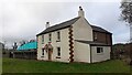
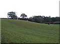
Farmhouse at Greenholme on north side of A69
Ordnance Survey documents indicate that a benchmark levelled at 26.786m above Newlyn Datum was verified in 1972 on the near corner of the house, which appears to have been rebuilt in recent times
Image: © Roger Templeman
Taken: 22 Dec 2022
0.10 miles