
IMAGES TAKEN NEAR TO
Lime House Gardens, CARLISLE, CA4 8FE
Introduction
This page details the photographs taken nearby to Lime House Gardens, CA4 8FE by members of the Geograph project.
The Geograph project started in 2005 with the aim of publishing, organising and preserving representative images for every square kilometre of Great Britain, Ireland and the Isle of Man.

There are currently over 7.5m images from over14,400 individuals and you can help contribute to the project by visiting https://www.geograph.org.uk
Image Map
Images are licensed for reuse under creativecommons.org/licenses/by-sa/2.0
Notes
- Clicking on the map will re-center to the selected point.
- The higher the marker number, the further away the image location is from the centre of the postcode.
Image Listing (104 Images Found)
Images are licensed for reuse under creativecommons.org/licenses/by-sa/2.0
Image
Details
Distance
1
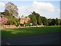
Killoran Hotel and village green at Wetheral
Image: © Roy Douglas
Taken: Unknown
0.05 miles
4
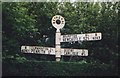
Old Direction Sign - Signpost by the B6263, Steele's Bank, Wetheral
Annulus finial - 3 arms; Cumberland named halo by the B6263, in parish of Wetheral (Carlisle District), Wetheral village, North of The Green.
surveyed
Milestone Society National ID: CU_NY4654.
Image: © Milestone Society
Taken: Unknown
0.06 miles
5
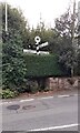
Cumberland County Council finger signpost on SW side of B6263
The signpost has Milestone Society National ID: CU_NY4654
Image: © Roger Templeman
Taken: 31 Aug 2021
0.06 miles
7
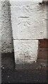
Benchmark on Maycote
Ordnance Survey cut mark benchmark described on the Bench Mark Database at www.bench-marks.org.uk/bm137272
Image: © Roger Templeman
Taken: 31 Aug 2021
0.07 miles
8
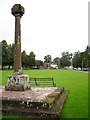
Wetheral cross and village green
The steps to the cross were originally in the centre of the green, forming the base to a wooden maypole erected in 1814 by Henry Howard of Corby Castle. The steps were moved to the present location, and the maypole replaced by the stone cross, around 1844.
Information taken from English Heritage listed building description http://list.english-heritage.org.uk/resultsingle.aspx?uid=1323117 , which also points out "This is not a market cross as Wetheral was not a market town".
Image: © Rose and Trev Clough
Taken: 20 Aug 2011
0.07 miles
9
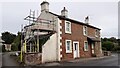
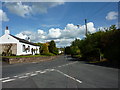
Maycote on east side of B6263
There is an Ordnance Survey benchmark Image on the near corner of the house, on the road face of the 2nd white-painted quoin above the pavement
Image: © Roger Templeman
Taken: 31 Aug 2021
0.08 miles
10
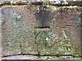
Benchmark, Wetheral, Manor Cottage
Detail of the Ordnance Survey cut benchmark on the wall pier of the garden wall of Manor Cottage. The benchmark marks a height of 65.0813m above mean sea level (Ordnance Datum Newlyn) last verified in 1972 (location photograph Image).
Image: © Adrian Taylor
Taken: 4 Mar 2022
0.08 miles