Wetheral cross and village green
Introduction
The photograph on this page of Wetheral cross and village green by Rose and Trev Clough as part of the Geograph project.
The Geograph project started in 2005 with the aim of publishing, organising and preserving representative images for every square kilometre of Great Britain, Ireland and the Isle of Man.

There are currently over 7.5m images from over 14,400 individuals and you can help contribute to the project by visiting https://www.geograph.org.uk
Wetheral cross and village green
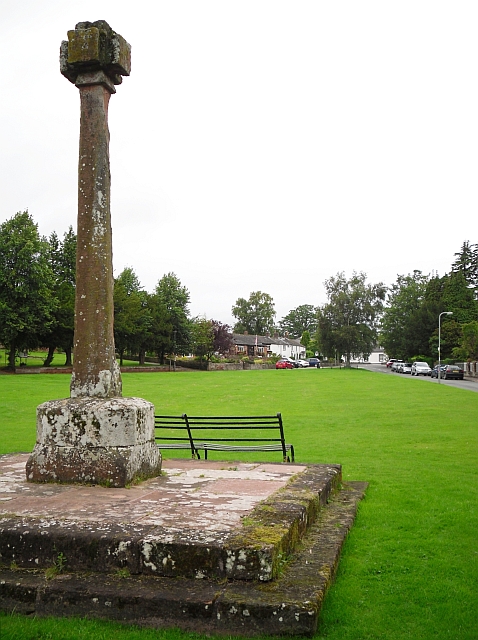
Image: © Rose and Trev Clough Taken: 20 Aug 2011
The steps to the cross were originally in the centre of the green, forming the base to a wooden maypole erected in 1814 by Henry Howard of Corby Castle. The steps were moved to the present location, and the maypole replaced by the stone cross, around 1844. Information taken from English Heritage listed building description http://list.english-heritage.org.uk/resultsingle.aspx?uid=1323117 , which also points out "This is not a market cross as Wetheral was not a market town".
Images are licensed for reuse under creativecommons.org/licenses/by-sa/2.0
Image Location
Latitude
54.881402
Longitude
-2.833222