
IMAGES TAKEN NEAR TO
Mulcaster Crescent, CARLISLE, CA3 9EA
Introduction
This page details the photographs taken nearby to Mulcaster Crescent, CA3 9EA by members of the Geograph project.
The Geograph project started in 2005 with the aim of publishing, organising and preserving representative images for every square kilometre of Great Britain, Ireland and the Isle of Man.

There are currently over 7.5m images from over14,400 individuals and you can help contribute to the project by visiting https://www.geograph.org.uk
Image Map
Images are licensed for reuse under creativecommons.org/licenses/by-sa/2.0
Notes
- Clicking on the map will re-center to the selected point.
- The higher the marker number, the further away the image location is from the centre of the postcode.
Image Listing (102 Images Found)
Images are licensed for reuse under creativecommons.org/licenses/by-sa/2.0
Image
Details
Distance
1
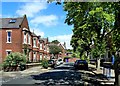
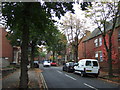
Mulcaster Crescent
A residential area on the north side of Carlisle.
Image: © Mary and Angus Hogg
Taken: 5 Jul 2014
0.02 miles
2
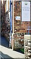
Benchmark on Stanwix School
Ordnance Survey cut mark benchmark in the bricks on the left hand face of the near corner of the school building about half way between ground and the bend in the downpipe, described on the Bench Mark Database at www.bench-marks.org.uk/bm30941
Image: © Roger Templeman
Taken: 15 Apr 2021
0.02 miles
3
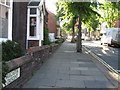
Mulcaster Crescent, Stanwix, Carlisle
Image: © Alex McGregor
Taken: 13 Jul 2010
0.03 miles
4
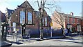
Stanwix Primary School on south side of Mulcaster Crescent
There is an Ordnance Survey benchmark Image on the left hand side of the school building at its front corner
Image: © Luke Shaw
Taken: 15 Apr 2021
0.03 miles
6
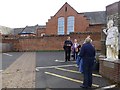
Track of Hadrian's Wall, Carlisle
Looking north-east in the car park behind the Cumbria Park Hotel
The wall ran along the line of the cobbles
In the background is Image]
Image: © Kenneth Allen
Taken: 20 Apr 2013
0.04 miles
7
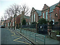
Stanwix Primary School
On Mulcaster Crescent to the north of Carlisle city centre.
Image: © Jonathan Billinger
Taken: 13 Feb 2008
0.05 miles
8
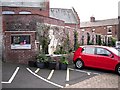
Site of Uxelodunum Roman fort in Stanwix
The information board and statue are in the car park of the Cumbria Park Hotel, with Stanwix Primary School behind.
This was the north western side of Uxelodunum, the biggest fort on Hadrian's Wall. It covered nearly 4 hectares, with massive stone buildings surrounded by a wall, banks and ditches. The fort housed the largest auxiliary regiment in the British province, known as the ala Petriania, which had up to 1,000 cavalry. This part of the car park was excavated by Carlisle Archaeological Unit in 1984. Some photographs of the dig can be seen on the board, information from which has been used for this description.
Sadly for the local tourist industry, nothing of the magnificent fort remains above ground today.
Image: © Rose and Trev Clough
Taken: 17 Sep 2009
0.05 miles
9
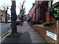
Mulcaster Crescent, Carlisle
Heading east from Scotland Road
Image: © Kenneth Allen
Taken: 21 Apr 2013
0.05 miles
10
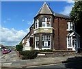
Mulcaster Crescent Corner
Viewed at the junction of Mulcaster Crescent and Scotland Road, just inside the square.
Image: © Mary and Angus Hogg
Taken: 5 Jul 2014
0.05 miles