IMAGES TAKEN NEAR TO
St. Albans Row, CARLISLE, CA3 8JF

Introduction

This page details the photographs taken nearby to St. Albans Row, CA3 8JF by members of the Geograph project.

The Geograph project started in 2005 with the aim of publishing, organising and preserving representative images for every square kilometre of Great Britain, Ireland and the Isle of Man.

There are currently over 7.5m images from over14,400 individuals and you can help contribute to the project by visiting https://www.geograph.org.uk

Image Map


Images are licensed for reuse under creativecommons.org/licenses/by-sa/2.0
Notes
  • Clicking on the map will re-center to the selected point.
  • The higher the marker number, the further away the image location is from the centre of the postcode.

Image Listing (1572 Images Found)

Images are licensed for reuse under creativecommons.org/licenses/by-sa/2.0
  • ...
Image
Details
Distance
1
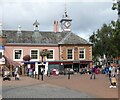
The Old Town Hall, Carlisle
The Old Town Hall is a Grade I listed building; it houses Carlisle’s Tourist Information Centre on the first floor. The Tourist Information Centre marks the northern end of The Cumbria Way, a 119km (74 mile) long distance path connecting Ulverston and Carlisle.
Image: © Adrian Taylor Taken: 1 Oct 2013
0.00 miles
2
Angel on the roof
Christmas decoration at Carlisle's Old Town Hall - for location see http://www.geograph.org.uk/photo/959810 .
Image: © Rose and Trev Clough Taken: 25 Dec 2009
0.00 miles
3
St Albans Row
Shops at the rear of the Old Town Hall.
Image: © Thomas Nugent Taken: 3 Jan 2015
0.00 miles
4
Old Town Hall, Carlisle
Now housing the Tourist Information Centre and various other shops. https://britishlistedbuildings.co.uk/101218104-old-town-hall-carlisle#.X24SbmhKg2w
Image: © Eirian Evans Taken: 10 Sep 2020
0.00 miles
5
Old Town Hall
In the Market Place now a variety of shops and Tourist Information Centre
Image: © Kevin Waterhouse Taken: 22 Aug 2023
0.00 miles
6
The Old Town Hall, Carlisle
The Old Town Hall is a Grade I listed building; it houses Carlisle’s Tourist Information Centre on the first floor. The Tourist Information Centre marks the northern end of The Cumbria Way, a 119km (74 mile) long distance path connecting Ulverston and Carlisle.
Image: © Adrian Taylor Taken: 6 Aug 2022
0.00 miles
7
St Alban's Row, Carlisle
A narrow shopping street at the rear of the Old Town Hall. Early to mid 18th century houses now with modern shops at ground floor level. Listed Grade II.
Image: © Alan Murray-Rust Taken: 8 Jul 2018
0.00 miles
8
End of The Cumbria Way
The Cumbria Way, a 119km (74 mile) long distance path from Ulverston through the heart of the Lake District, ends at the top of the steps of the Old Town Hall in Carlisle City Centre. The Old Town Hall is a Grade I listed building and houses Carlisle’s Tourist Information Centre on the first floor (photograph Image).
Image: © Adrian Taylor Taken: 9 Feb 2023
0.00 miles
9
Old Town Hall
The Grade I listed https://historicengland.org.uk/listing/the-list/list-entry/1218104 Old Town Hall on Green Market dates back to 1668 It was extended in 1717 and a clock tower added. It served as the meeting place for the city council and lawcourts until 1964. Now it houses the tourist information centre and Costa Coffee.
Image: © Gerald England Taken: 11 Sep 2021
0.00 miles
10
Town Hall Clock Tower
Clock tower on the Old Town Hall Image It bears the inscription: JOHN RICHARDSON ESQ. MAYOR, 1800
Image: © Gerald England Taken: 11 Sep 2021
0.00 miles
  • ...