
IMAGES TAKEN NEAR TO
Drumburgh Avenue, CARLISLE, CA3 0PD
Introduction
This page details the photographs taken nearby to Drumburgh Avenue, CA3 0PD by members of the Geograph project.
The Geograph project started in 2005 with the aim of publishing, organising and preserving representative images for every square kilometre of Great Britain, Ireland and the Isle of Man.

There are currently over 7.5m images from over14,400 individuals and you can help contribute to the project by visiting https://www.geograph.org.uk
Image Map
Images are licensed for reuse under creativecommons.org/licenses/by-sa/2.0
Notes
- Clicking on the map will re-center to the selected point.
- The higher the marker number, the further away the image location is from the centre of the postcode.
Image Listing (27 Images Found)
Images are licensed for reuse under creativecommons.org/licenses/by-sa/2.0
Image
Details
Distance
1
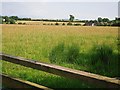
View across a field from California Lane
The white building on the left is at Shortdale (near Tarraby), houses on the right are at Wolsty Close.
This field and one beyond are earmarked for a large housing development (277 dwellings).
Image: © Rose and Trev Clough
Taken: 18 Aug 2016
0.09 miles
2
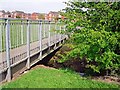
Footbridge across Gosling Sike
This small stream runs through green amenity space between Wolsty Close (seen in distance) and Windsor Way.
Image: © Rose and Trev Clough
Taken: 10 May 2016
0.10 miles
3
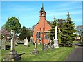
Chapel at Stanwix Cemetery
This municipal cemetery opened in 1887 - the chapel is still in use.
Image: © Rose and Trev Clough
Taken: 17 Apr 2011
0.11 miles
4
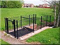
Gosling Sike going into a culvert
A small stream, which is culverted under the road at Windsor Way.
The screen may have been installed to stop debris blocking the culvert, or to prevent children going in, or both https://www.gov.uk/government/publications/trash-and-security-screen-guide-2009 .
Image: © Rose and Trev Clough
Taken: 10 May 2016
0.11 miles
5
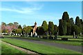
Part of Stanwix Cemetery
The cemetery is run by Carlisle City Council.
Image: © Rose and Trev Clough
Taken: 17 Apr 2011
0.12 miles
6
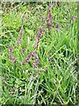
Red bartsia (Odontites vernus)
Growing near the hedge round this grass field Image .
Red bartsia is 'a common plant of roadside verges, railway cuttings, waste grounds and other disturbed ground' http://www.wildlifetrusts.org/species/red-bartsia .
Image: © Rose and Trev Clough
Taken: 18 Aug 2016
0.12 miles
7
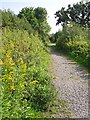
California Lane (behind Newfield Park)
Image: © Rose and Trev Clough
Taken: 18 Aug 2016
0.13 miles
8
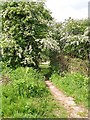
Cut between California Lane and Newfield Drive
Image: © Rose and Trev Clough
Taken: 19 May 2014
0.15 miles
9

War memorial, Stanwix Cemetery
The monument commemorates 'those of this parish' who died in the First World War, which refers to St. Michael's Church, Stanwix (the nearest Anglican church to Stanwix Cemetery today is St. Peter's, Kingmoor, but that was not established until 1931).
For a close look at the inscription, see Image .
Image: © Rose and Trev Clough
Taken: 17 Apr 2011
0.16 miles
10
Plaque on war memorial
For the setting, see Image .
Image: © Rose and Trev Clough
Taken: 17 Apr 2011
0.16 miles