
IMAGES TAKEN NEAR TO
Millcroft, CARLISLE, CA3 0HT
Introduction
This page details the photographs taken nearby to Millcroft, CA3 0HT by members of the Geograph project.
The Geograph project started in 2005 with the aim of publishing, organising and preserving representative images for every square kilometre of Great Britain, Ireland and the Isle of Man.

There are currently over 7.5m images from over14,400 individuals and you can help contribute to the project by visiting https://www.geograph.org.uk
Image Map
Images are licensed for reuse under creativecommons.org/licenses/by-sa/2.0
Notes
- Clicking on the map will re-center to the selected point.
- The higher the marker number, the further away the image location is from the centre of the postcode.
Image Listing (28 Images Found)
Images are licensed for reuse under creativecommons.org/licenses/by-sa/2.0
Image
Details
Distance
1
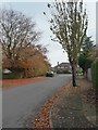
Autumn leaves, Longlands Road, Carlisle
Lots of colour at the beginning of November.
Image: © Christine Johnstone
Taken: 2 Nov 2015
0.10 miles
2
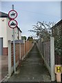
Public footpath, Whiteclosegate, Carlisle
Between Longlands Road and Millcroft.
Image: © Christine Johnstone
Taken: 2 Nov 2015
0.11 miles
4
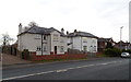
Whiteclosegate, Carlisle
Semi detached houses on Whiteclosegate on the eastern side of Carlisle.
Image: © Graham Robson
Taken: 6 Oct 2018
0.13 miles
5
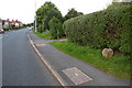
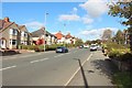
Looking NE along the B6264
There is a boundary stone Image on the grass verge in the right foreground
Image: © Roger Templeman
Taken: 16 Sep 2019
0.13 miles
7
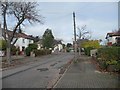
The northern end of Croft Road, Carlisle
Forming a T junction with Longlands Road.
Image: © Christine Johnstone
Taken: 2 Nov 2015
0.14 miles
8
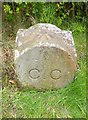
Old Boundary Marker the B6264, Whiteclosegate, Carlisle parish
Parish Boundary Marker by the B6264 (was A689), in parish of Carlisle (Carlisle District), Whiteclosegate, opposite footpath, in front of No 2 on verge, Southeast side of road.
Inscription reads:-
C.C
Carved bench mark and pivot on top.
Surveyed
Milestone Society National ID: CU_CL02pb
Image: © Milestone Society
Taken: Unknown
0.14 miles
9
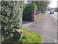
Carlisle city boundary stone, Whiteclosegate
Stone dated 1912 - for information see Image .
Near to the junction with Longlands Road, where a white van is passing by.
Image: © Rose and Trev Clough
Taken: 29 Sep 2017
0.14 miles
10
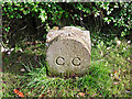
City boundary stone, Whiteclosegate (close look)
For location, see Image .
Stone marker inscribed 'C.C 1912'. CC probably stands for City of Carlisle (or possibly Carlisle Corporation).
In 1912 the municipal borough and civil parish of Carlisle was extended, taking in parts of the parishes of Belle Vue, Cummersdale, Stanwix and St. Cuthbert Without, including the townships of Upperby, Harraby and Botcherby (Kelly's directory of Cumberland and Westmorland, 1914 http://specialcollections.le.ac.uk/cdm/ref/collection/p16445coll4/id/278531 ). There is a similar stone on the outskirts of Harraby Image .
The carved arrow on top of the stone is an Ordnance Survey bench mark (recorded on Bench Mark Database http://www.bench-marks.org.uk/bm30939 ).
Image: © Rose and Trev Clough
Taken: 29 Sep 2017
0.14 miles