City boundary stone, Whiteclosegate (close look)
Introduction
The photograph on this page of City boundary stone, Whiteclosegate (close look) by Rose and Trev Clough as part of the Geograph project.
The Geograph project started in 2005 with the aim of publishing, organising and preserving representative images for every square kilometre of Great Britain, Ireland and the Isle of Man.

There are currently over 7.5m images from over 14,400 individuals and you can help contribute to the project by visiting https://www.geograph.org.uk
City boundary stone, Whiteclosegate (close look)
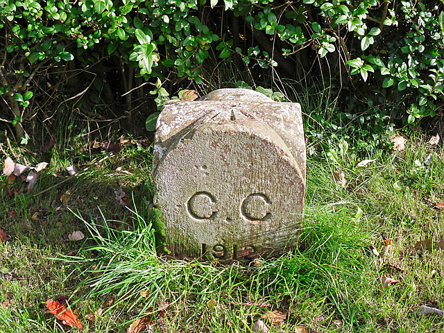
Image: © Rose and Trev Clough Taken: 29 Sep 2017
For location, see Image . Stone marker inscribed 'C.C 1912'. CC probably stands for City of Carlisle (or possibly Carlisle Corporation). In 1912 the municipal borough and civil parish of Carlisle was extended, taking in parts of the parishes of Belle Vue, Cummersdale, Stanwix and St. Cuthbert Without, including the townships of Upperby, Harraby and Botcherby (Kelly's directory of Cumberland and Westmorland, 1914 http://specialcollections.le.ac.uk/cdm/ref/collection/p16445coll4/id/278531 ). There is a similar stone on the outskirts of Harraby Image . The carved arrow on top of the stone is an Ordnance Survey bench mark (recorded on Bench Mark Database http://www.bench-marks.org.uk/bm30939 ).
Images are licensed for reuse under creativecommons.org/licenses/by-sa/2.0
Image Location
Latitude
54.910778
Longitude
-2.921803