IMAGES TAKEN NEAR TO
Thomas Lane, CARLISLE, CA2 7ND
Introduction
This page details the photographs taken nearby to Thomas Lane, CA2 7ND by members of the Geograph project.
The Geograph project started in 2005 with the aim of publishing, organising and preserving representative images for every square kilometre of Great Britain, Ireland and the Isle of Man.

There are currently over 7.5m images from over14,400 individuals and you can help contribute to the project by visiting https://www.geograph.org.uk
Image Map
Images are licensed for reuse under creativecommons.org/licenses/by-sa/2.0
Notes
- Clicking on the map will re-center to the selected point.
- The higher the marker number, the further away the image location is from the centre of the postcode.
Image Listing (26 Images Found)
Images are licensed for reuse under creativecommons.org/licenses/by-sa/2.0
Image
Details
Distance
1
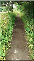
Looking east along former trackbed of dismantled railway
Image: © Roger Templeman
Taken: 12 Jul 2021
0.06 miles
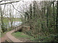
3
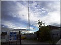
View from embankment of dismantled railway towards Hadrian's Wall path
The metal fence at the right hand side of the image is at a bend in a footpath
Image: © Roger Templeman
Taken: 12 Jul 2021
0.11 miles
5
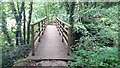
Footbridge over stream tributary to River Eden
Image: © Roger Templeman
Taken: 12 Jul 2021
0.13 miles
7
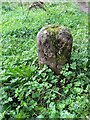
Old Boundary Marker beside the River Eden in Carlisle
Municipal Boundary Marker beside the Hadrian’s Wall Path on the south bank of the River Eden in Carlisle. It seems to display the Carlisle coat of arms and was on the city and borough boundary until 1912.
Milestone Society National ID: CU_CARL07pb
Image: © D Elis-Williams
Taken: 1 Sep 2023
0.14 miles
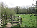
8
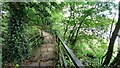
Steps on footpath at approach to footbridge over stream
Ordnance Survey records indicate that a benchmark levelled at 10.931m above Newlyn Datum was verified in 1972 on the bridge abutment on the right hand side of the path
Image: © Roger Templeman
Taken: 12 Jul 2021
0.14 miles
9
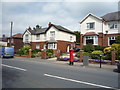
Houses on Newtown Road, Carlisle
Showing position of Postbox No. CA2 96.
See Image] for postbox.
Image: © JThomas
Taken: 28 May 2016
0.15 miles
10
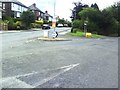
Road junction on B5307
Fork in B5307 where it changes from Newtown Road to Moorhouse Road, with the RHS of fork being Burgh Road.
Image: © Roger Templeman
Taken: 17 Jul 2010
0.15 miles