
IMAGES TAKEN NEAR TO
Dalton Close, CARLISLE, CA2 7FF
Introduction
This page details the photographs taken nearby to Dalton Close, CA2 7FF by members of the Geograph project.
The Geograph project started in 2005 with the aim of publishing, organising and preserving representative images for every square kilometre of Great Britain, Ireland and the Isle of Man.

There are currently over 7.5m images from over14,400 individuals and you can help contribute to the project by visiting https://www.geograph.org.uk
Image Map
Images are licensed for reuse under creativecommons.org/licenses/by-sa/2.0
Notes
- Clicking on the map will re-center to the selected point.
- The higher the marker number, the further away the image location is from the centre of the postcode.
Image Listing (43 Images Found)
Images are licensed for reuse under creativecommons.org/licenses/by-sa/2.0
Image
Details
Distance
1
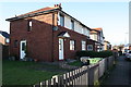
Houses on Balfour Road
There is an OS benchmark Image on the nearest house at its front corner, left hand face
Image: © Luke Shaw
Taken: 3 Jan 2020
0.07 miles
2
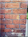
Benchmark on #33 Balfour Road
Ordnance Survey cut mark benchmark on SE face of house. More information on the mark can be found on the Bench Mark Database at http://www.bench-marks.org.uk/bm34922.
Image: © Roger Templeman
Taken: 17 Jul 2010
0.08 miles
3
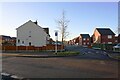
Houses of Creighton Avenue at Dalton Avenue junction
Ordnance Survey records indicate that a benchmark levelled at 25.521m above Newlyn Datum was verified in 1972 on the side of the nearest house on the left hand side of Creighton Avenue (#48). The house is now rendered with loss of the benchmark. See www.bench-marks.org.uk/bm114984
Image: © Luke Shaw
Taken: 29 Nov 2019
0.10 miles
4
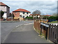
Dalton Avenue, Carlisle
Running north from Orton Road.
Image: © Christine Johnstone
Taken: 11 Apr 2014
0.10 miles
5
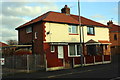
Nos. 48 and 46 Orton Road, next to Raffles electricity substation
There is an OS benchmark Image on the side of the left hand house near its front corner
Image: © Luke Shaw
Taken: 3 Dec 2019
0.11 miles
6
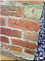
Benchmark on #48 Orton Road
Ordnance Survey cut mark benchmark on the side of the house. The mark is described in detail on the Bench Mark Database at http://www.bench-marks.org.uk/bm34903.
Image: © Roger Templeman
Taken: 17 Jul 2010
0.11 miles
7
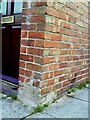
Benchmark on #178 Raffles Avenue
Ordnance Survey cut mark benchmark which is described on the Bench Mark Database at http://www.bench-marks.org.uk/bm34898.
Image: © Roger Templeman
Taken: 17 Jul 2010
0.12 miles
8
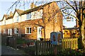
Houses on the east side of Raffles Avenue
There is an Ordnance Survey benchmark Image on the side of the nearest house at its front corner
Image: © Luke Shaw
Taken: 29 Nov 2019
0.13 miles
9
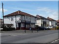
Bells Newsagents, Orton Road, Carlisle
At the corner of Inglewood Road.
Image: © Christine Johnstone
Taken: 11 Apr 2014
0.13 miles
10
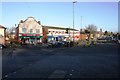
Shops set back from Wigton Road at Orton Road junction
The Rafles toll gate was situated here in 1844. but demolished in 1931. See https://www.bench-marks.org.uk/bm38810
Image: © Luke Shaw
Taken: 3 Jan 2020
0.13 miles