
IMAGES TAKEN NEAR TO
Scalegate Road, CARLISLE, CA2 4PR
Introduction
This page details the photographs taken nearby to Scalegate Road, CA2 4PR by members of the Geograph project.
The Geograph project started in 2005 with the aim of publishing, organising and preserving representative images for every square kilometre of Great Britain, Ireland and the Isle of Man.

There are currently over 7.5m images from over14,400 individuals and you can help contribute to the project by visiting https://www.geograph.org.uk
Image Map
Images are licensed for reuse under creativecommons.org/licenses/by-sa/2.0
Notes
- Clicking on the map will re-center to the selected point.
- The higher the marker number, the further away the image location is from the centre of the postcode.
Image Listing (72 Images Found)
Images are licensed for reuse under creativecommons.org/licenses/by-sa/2.0
Image
Details
Distance
1
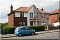
Nos. 180 and 178 Scalegate Road
Ordnance Survey records indicate that a benchmark was levelled on the front on the right hand house at its front corner now pebbledashed. See www.bench-marks.org.uk/bm103412
Image: © Luke Shaw
Taken: 1 Sep 2020
0.04 miles
2
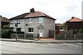
Nos 116 and 114 Scalegate Road at Buchanan Road junction
Ordnance Survey records indicate that a benchmark levelled at 38.173m above Newlyn Datum was verified in 1972 on the side of the right hand house (No. 114) at its front corner, now pebbledashed
Image: © Luke Shaw
Taken: 1 Sep 2020
0.04 miles
3
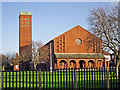
St Margaret Mary's Catholic Church, Upperby
The parish was founded in 1933. The present church in Scalegate Road opened in 1961.
Image: © Rose and Trev Clough
Taken: 26 Dec 2013
0.11 miles
5
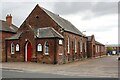
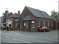
Upperby Methodist Church, Upperby Road at Nursery Road junction
There is an Ordnance Survey benchmark Image just above the pavement left of the main road porch door
Image: © Luke Shaw
Taken: 1 Sep 2020
0.12 miles
6
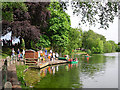
Boating at Hammonds Pond
Upperby Gala day in 2010.
For information about the history of Hammonds Pond (formerly Pleasureland) see archived version of Carlisle City Council website https://web.archive.org/web/20130515110036/http://www.carlisle.gov.uk/leisure_and_culture/parks_and_open_spaces/park_locations/hammonds_pond/hammonds_pond_history.aspx .
Image: © Rose and Trev Clough
Taken: 31 May 2010
0.12 miles
7
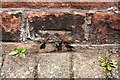
Benchmark on front of Upperby Methodist Church
Ordnance Survey cut mark benchmark levelled at 42.228m above Newlyn Datum verified in 1972
Image: © Luke Shaw
Taken: 1 Sep 2020
0.13 miles
8
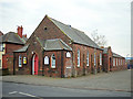
Upperby Methodist Church
A stone plaque above the door is inscribed 'PRIMITIVE METHODIST CHURCH.1901.' For further information, see http://www.myprimitivemethodists.org.uk/page_id__62.aspx?path=0p9p22p .
The church is on the corner of Upperby Road and Nursery Road (right). The latter leads to a side entrance at Upperby Primary School, but the road's name is not related to the school's infants - it refers to a plant nursery which used to occupy nearby land.
Image: © Rose and Trev Clough
Taken: 24 Jan 2013
0.13 miles
9
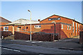
St Margaret Mary's Social Club
The club is adjacent to the Roman Catholic parish church in Scalegate Road.
Image: © Rose and Trev Clough
Taken: 26 Dec 2013
0.13 miles
10
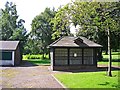
Disused dovecote, Hammond's Pond
The dovecote and adjacent aviary (left) were a popular attraction at this park for many years - see Image .
The birds have gone now. Not long after this picture was taken, the dovecote was demolished.
Hammond's Pond belongs to Carlisle City Council http://www.carlisle.gov.uk/Residents/Leisure/Parks-and-Open-Spaces/hammonds-pond .
Image: © Rose and Trev Clough
Taken: 18 Jul 2017
0.13 miles