IMAGES TAKEN NEAR TO
Eskdale, HOLMROOK, CA19 1TJ
Introduction
This page details the photographs taken nearby to CA19 1TJ by members of the Geograph project.
The Geograph project started in 2005 with the aim of publishing, organising and preserving representative images for every square kilometre of Great Britain, Ireland and the Isle of Man.

There are currently over 7.5m images from over14,400 individuals and you can help contribute to the project by visiting https://www.geograph.org.uk
Image Map
Images are licensed for reuse under creativecommons.org/licenses/by-sa/2.0
Notes
- Clicking on the map will re-center to the selected point.
- The higher the marker number, the further away the image location is from the centre of the postcode.
Image Listing (13 Images Found)
Images are licensed for reuse under creativecommons.org/licenses/by-sa/2.0
Image
Details
Distance
1
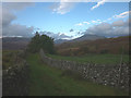
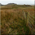
Footpath north of Birkerthwaite
A grassy path between walls with a view forwards to Scafell.
Image: © Karl and Ali
Taken: 16 Oct 2016
0.07 miles
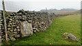
2
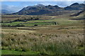
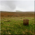
On Birker Fell
Crossing the very wet fell towards the road.
Image: © Michael Graham
Taken: 18 Apr 2009
0.11 miles
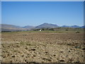
4
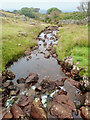
Farmland between Birkerthwaite and High Ground
Area S of western Eskdale. Looking S from the footpath at SD 178 984.
Image: © Steve Partridge
Taken: 15 Oct 2005
0.12 miles
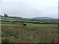
6
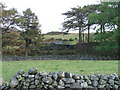
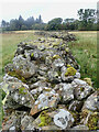
Small barn near between Ellerbeck Bridge and Birkerthwaite
Looking E from the footpath at SD 178 984.
Image: © Steve Partridge
Taken: 15 Oct 2005
0.18 miles