IMAGES TAKEN NEAR TO
Rookby, KIRKBY STEPHEN, CA17 4JB
Introduction
This page details the photographs taken nearby to CA17 4JB by members of the Geograph project.
The Geograph project started in 2005 with the aim of publishing, organising and preserving representative images for every square kilometre of Great Britain, Ireland and the Isle of Man.

There are currently over 7.5m images from over14,400 individuals and you can help contribute to the project by visiting https://www.geograph.org.uk
Image Map
Images are licensed for reuse under creativecommons.org/licenses/by-sa/2.0
Notes
- Clicking on the map will re-center to the selected point.
- The higher the marker number, the further away the image location is from the centre of the postcode.
Image Listing (14 Images Found)
Images are licensed for reuse under creativecommons.org/licenses/by-sa/2.0
Image
Details
Distance
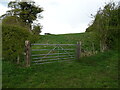
3
Bridleway at Seldomin
A short bridleway cutting off a road loop. The sun is lighting up the limestone escarpments to the north of Brough.
Image: © Karl and Ali
Taken: 22 Nov 2014
0.03 miles
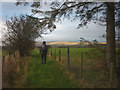
5

National Cycle Route 70, Seldomin
Towards Duckintree.
Image: © JThomas
Taken: 30 Apr 2021
0.04 miles
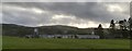
6
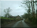
Road north to Kaber from T-junction in Rookby
Image: © Roger Templeman
Taken: 1 Mar 2022
0.10 miles
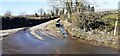
7
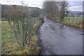
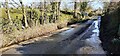
Lane to Rookby
Seen from the Kaber - Barras road. Thanks to the post-Christmas thaw there is now virtually no snow in sight but only a couple of days previously this lane had been barely passable.
Image: © Stephen McKay
Taken: 29 Dec 2010
0.14 miles