IMAGES TAKEN NEAR TO
Beeches Mews, APPLEBY-IN-WESTMORLAND, CA16 6EL

Introduction

This page details the photographs taken nearby to Beeches Mews, CA16 6EL by members of the Geograph project.

The Geograph project started in 2005 with the aim of publishing, organising and preserving representative images for every square kilometre of Great Britain, Ireland and the Isle of Man.

There are currently over 7.5m images from over14,400 individuals and you can help contribute to the project by visiting https://www.geograph.org.uk

Image Map


Images are licensed for reuse under creativecommons.org/licenses/by-sa/2.0
Notes
  • Clicking on the map will re-center to the selected point.
  • The higher the marker number, the further away the image location is from the centre of the postcode.

Image Listing (22 Images Found)

Images are licensed for reuse under creativecommons.org/licenses/by-sa/2.0
  • ...
Image
Details
Distance
1
London 273 Miles
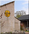
AA sign in the village
Image: © Martin Dawes Taken: 16 May 2012
0.01 miles
2
AA village sign
The old AA sign for Great Ormside was originally fixed to an older building nearby. It was moved to its present location when that building was redeveloped.
Image: © Rob Burke Taken: 1 May 2010
0.05 miles
3
Old circular AA Sign in Great Ormside
Old AA Sign located on a gable end near the village notice board in Great Ormside, 3 miles southeast of Appleby. Ormside parish. This is the circular, village name on black band, no Motor Union symbol or name type, dating from 1923 and showing distances Appleby 2½ Soulby 6 London 273. There were five series of AA signs, mostly dating from 1923 and made by Francis & Co / Franco in Deptford, London. The village name and distance to London were displayed. See also https://www.flickr.com/photos/katie_pickersgill/50170384023 , http://www.geograph.org.uk/photo/1882255 and http://www.geograph.org.uk/photo/3132148. Milestone Society National ID: CB-GTORM
Image: © Milestone Society Taken: Unknown
0.06 miles
4
Village Postbox
Victorian postbox and footpath going to the west of the village, road goes up Leazes Hill.
Image: © Martin Dawes Taken: 16 May 2012
0.08 miles
5
Old Wayside Cross on village green, Ormside parish
Ormside Cross base, old base and steps by the UC road, in parish of Ormside (Eden District), village green, South of church, cross head is CBED_ORM02 Image in churchyard. Grade II listed. List Entry Number: 1144896 https://historicengland.org.uk/listing/the-list/list-entry/1144896 Surveyed Milestone Society National ID: CBED_ORM01
Image: © Milestone Society Taken: Unknown
0.08 miles
6
Lane to Ormside Hall and St James's Church
The church can be seen over the cottage, it dates from at least the 11th century
Image: © Martin Dawes Taken: 16 May 2012
0.10 miles
7
Tree at Great Ormside with seating arrangement
Image: © David Brown Taken: 29 Jul 2008
0.12 miles
8
St James Church,Ormside
Image: © Alexander P Kapp Taken: 7 Sep 2006
0.13 miles
9
Ormside Hall
14th century Hall - now a farm, with a pele tower.
Image: © mauldy Taken: 13 Sep 2003
0.15 miles
10
Church of St James, Great Ormside
South porch
Image: © David McMumm Taken: 22 Jun 2010
0.15 miles
  • ...