1
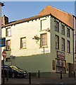
Crosby Street, Maryport
Image: © Bill Boaden
Taken: 19 Jul 2010
0.02 miles
2
Crosby Street, Maryport
Looking north along Crosby Street, Maryport, with a police car in the foreground.
Image: © Graham Robson
Taken: 14 Jul 2012
0.02 miles
3
White Star Pub - Maryport - July 2016
Closed and currently for sale.
Photograph is for record only - I have no connection with any party involved in the sale of these premises and cannot advise on their products or services.
Image: © The Carlisle Kid
Taken: 3 Jul 2016
0.02 miles
4
Butchers Arms, Crosby Street, Maryport - June 2017
Early 19th Century pub first mentioned in Slaters Directory of 1848. Still trading.
Photograph is for record only - I have no connection with this business and cannot advise on its products or services.
Image: © The Carlisle Kid
Taken: 19 Jun 2017
0.02 miles
5
Former "Shakespear" pub, Maryport - October 2017
First mentioned in the Post Office Directory of 1873, the pub does not appear on the 1865 OS Map which suggests it opened between these dates. Acquired by the State Management Scheme in November 1918, no record has yet been found of sale - although it is marked on the 1970 OS Map. This - as I have discovered - means little!
Premises are now "Mr Simms Olde Sweet Shoppe" - with whom I have no connection and, while tempted, cannot advise on its products or services.
Image: © The Carlisle Kid
Taken: 27 Oct 2017
0.03 miles
6
Former "Empire Theatre", Stenhouse Street, Maryport - June 2017
Dating from 1910, the theatre/cinema closed in 1976 and was converted into retail units. An earlier view and potted history may be seen: http://cinematreasures.org/theaters/46125
Photograph is for record only - I have no connection with any business seen in this view and cannot advise on their products or services.
Image: © The Carlisle Kid
Taken: 19 Jun 2017
0.03 miles
7
The former Empire Theatre, Senhouse Street
Opened as a theatre in 1911, closed as a cinema in 1974.
Image: © Christine Johnstone
Taken: 28 Feb 2013
0.04 miles
8
Shops in Senhouse Street
The name "Empire Theatre" is carved in a stone below the semicircular gable to the left. The theatre opened in 1911, it was used as a cinema which closed 1974 http://www.allerdale.gov.uk/downloads/Maryport_Conservation_Area_Appraisal.pdf .
Image: © Rose and Trev Clough
Taken: 30 Sep 2010
0.04 miles
9
Mill Race Lonning at Senhouse Street
Image: © Phil Davies
Taken: 30 Mar 2008
0.04 miles
10
Former "Sun Inn", Wood Street, Maryport - October 2017
First appears in the 1811 "Cumberland Guide & Directory", the "Sun Inn" was acquired by the State Management Scheme in November 1918. No record has been found of its sale, but it appears on the 1970 OS Map.
Now the premises of MANA Credit Union.
Photograph is for record only - I have no connection with MANA Credit Union and cannot advise on their products or services.
Image: © The Carlisle Kid
Taken: 27 Oct 2017
0.04 miles


