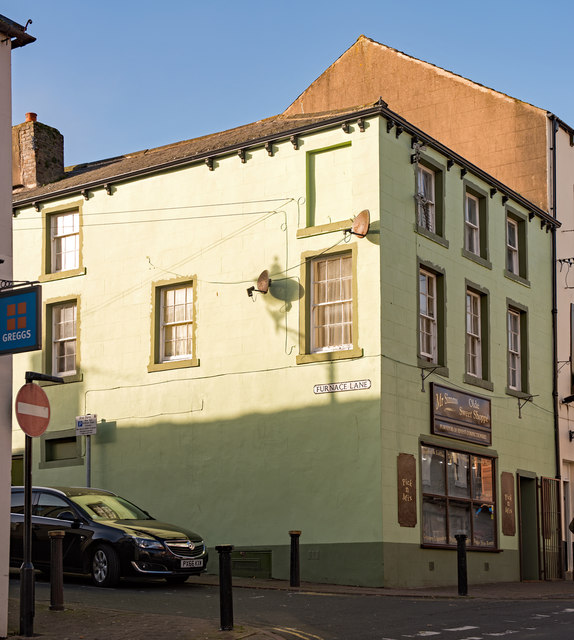
Former "Shakespear" pub, Maryport - October 2017
Introduction
The photograph on this page of Former "Shakespear" pub, Maryport - October 2017 by The Carlisle Kid as part of the Geograph project.
The Geograph project started in 2005 with the aim of publishing, organising and preserving representative images for every square kilometre of Great Britain, Ireland and the Isle of Man.
There are currently over 7.5m images from over 14,400 individuals and you can help contribute to the project by visiting https://www.geograph.org.uk

Image: © The Carlisle Kid Taken: 27 Oct 2017
First mentioned in the Post Office Directory of 1873, the pub does not appear on the 1865 OS Map which suggests it opened between these dates. Acquired by the State Management Scheme in November 1918, no record has yet been found of sale - although it is marked on the 1970 OS Map. This - as I have discovered - means little! Premises are now "Mr Simms Olde Sweet Shoppe" - with whom I have no connection and, while tempted, cannot advise on its products or services.

