IMAGES TAKEN NEAR TO
Admiral Way, CARLISLE, CA1 3PD
Introduction
This page details the photographs taken nearby to Admiral Way, CA1 3PD by members of the Geograph project.
The Geograph project started in 2005 with the aim of publishing, organising and preserving representative images for every square kilometre of Great Britain, Ireland and the Isle of Man.

There are currently over 7.5m images from over14,400 individuals and you can help contribute to the project by visiting https://www.geograph.org.uk
Image Map
Images are licensed for reuse under creativecommons.org/licenses/by-sa/2.0
Notes
- Clicking on the map will re-center to the selected point.
- The higher the marker number, the further away the image location is from the centre of the postcode.
Image Listing (10 Images Found)
Images are licensed for reuse under creativecommons.org/licenses/by-sa/2.0
Image
Details
Distance
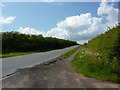
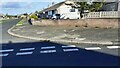
2
Junction on Cumwhinton Road, Carlisle
Image: © Alexander P Kapp
Taken: 16 Jun 2011
0.04 miles
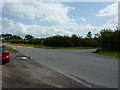
3
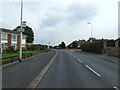
Approaching Harraby
A view looking to the northwest along Cumwhinton Drive towards the mini-roundabout at the junction with Garlands Road, approaching the residential area of Harraby.
Image: © Phil Williams
Taken: 17 Feb 2007
0.07 miles
4
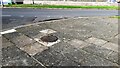
Manhole cover on pavement at junction of Farbrow Road and High Green Croft
Ordnance Survey records indicate that a benchmark levelled at 46.130m above Newlyn Datum was verified in 1972 on the concrete surround of the manhole cover
Image: © Roger Templeman
Taken: 21 Oct 2021
0.12 miles
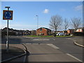
5
Bus stop on Cumwhinton Road
Looking south east.
Image: © JThomas
Taken: 10 Oct 2015
0.14 miles
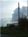
7
Junction of Farbrow Road and Mallyclose Drive
Ordnance Survey records indicate that a benchmark levelled at 49.841m above Newlyn Datum was verified in 1972 on the surround of the manhole cover in the pavement at this corner. See www.bench-marks.org.uk/bm74947
Image: © Roger Templeman
Taken: 21 Oct 2021
0.17 miles
10

Creighton Rugby Club
The club was founded in 1927, and moved to this site on Sycamore Lane in 2006. Previously they were based at Carr's Field, which now has houses on it Image .
Club website - http://www.creightonrufc.co.uk/index.html .
Image: © Rose and Trev Clough
Taken: 19 Jan 2010
0.25 miles