
IMAGES TAKEN NEAR TO
Hazel Close, CARLISLE, CA1 2FF
Introduction
This page details the photographs taken nearby to Hazel Close, CA1 2FF by members of the Geograph project.
The Geograph project started in 2005 with the aim of publishing, organising and preserving representative images for every square kilometre of Great Britain, Ireland and the Isle of Man.

There are currently over 7.5m images from over14,400 individuals and you can help contribute to the project by visiting https://www.geograph.org.uk
Image Map
Images are licensed for reuse under creativecommons.org/licenses/by-sa/2.0
Notes
- Clicking on the map will re-center to the selected point.
- The higher the marker number, the further away the image location is from the centre of the postcode.
Image Listing (56 Images Found)
Images are licensed for reuse under creativecommons.org/licenses/by-sa/2.0
Image
Details
Distance
1
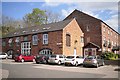
Old industrial buildings at Harraby Green
Now converted to business and residential use, part of Harraby Green Business Park. The location is Tannery Road - a bit of a clue to what was once there. Marked on old maps as a skinnery.
Image: © Rose and Trev Clough
Taken: 30 Apr 2013
0.06 miles
2
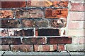
Benchmark on Chertsey Bank wall of No. 34 Lazonby Gardens
Ordnance Survey cut mark benchmark described on the Bench Mark Database at www.bench-marks.org.uk/bm102576
Image: © Luke Shaw
Taken: 24 Aug 2019
0.13 miles
3
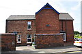
Chertsey Bank face of No. 34 Lazonby Gardens
There is an Ordnance Survey benchmark Image on the right hand end of the high brick wall in the middle of the image at its junction with a low brick wall
Image: © Luke Shaw
Taken: 24 Aug 2019
0.13 miles
4
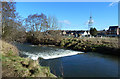
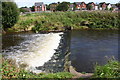
The River Petteril
A mid-February view looking across a weir on this river in central Carlisle.
Image: © Mary and Angus Hogg
Taken: 20 Feb 2018
0.15 miles
5
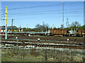
Railway scene at Carlisle
On approach to Carlisle station on a Glasgow bound train from Manchester Airport. The BT mast at Hillcrest Close can be seen on the right.
Image: © Thomas Nugent
Taken: 18 Apr 2014
0.15 miles
7
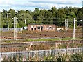
Railway hut, Upperby
Disused building at the southern end of a once busy railway yard.
Image: © Rose and Trev Clough
Taken: 2 Oct 2016
0.15 miles
8

Radio Mast
The BT Radio Mast on Hillcrest Avenue is a prominent landmark.
Image: © Weston Beggard
Taken: 20 Jan 2006
0.16 miles
9

Former toll cottage, London Road
Built in 1830 for the keeper of the Harraby Toll Gate, on the Carlisle to Eamont Bridge turnpike road (for information on turnpikes see Wikipedia http://en.wikipedia.org/wiki/Turnpike_trust ) .
The turnpike closed in 1883, when road maintenance became the responsibility of the local authority. The cottage was sold to the owner of nearby Chertsey House, to be used as a lodge.
Today it is a private residence.
Image: © Rose and Trev Clough
Taken: 31 Jul 2011
0.16 miles
10
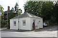
The Lodge, London Road at Chertsey Grove junction
Ordnance Survey documents indicate that a benchmark was levelled at 120.727 feet above Liverpool Datum on the near corner of this former toll house during the 1841-1844 Liverpool to Port Carlisle 1GL Survey. The surveyor's description of the mark was 'No. 465. Bolt in North-west corner of Harraby Toll-house ; 2.65 ft. above surface'. See www.bench-marks.org.uk/bm80950
Image: © Roger Templeman
Taken: 24 Aug 2019
0.16 miles