IMAGES TAKEN NEAR TO
Thackthwaite, PENRITH, CA11 0ND
Introduction
This page details the photographs taken nearby to CA11 0ND by members of the Geograph project.
The Geograph project started in 2005 with the aim of publishing, organising and preserving representative images for every square kilometre of Great Britain, Ireland and the Isle of Man.

There are currently over 7.5m images from over14,400 individuals and you can help contribute to the project by visiting https://www.geograph.org.uk
Image Map
Images are licensed for reuse under creativecommons.org/licenses/by-sa/2.0
Notes
- Clicking on the map will re-center to the selected point.
- The higher the marker number, the further away the image location is from the centre of the postcode.
Image Listing (12 Images Found)
Images are licensed for reuse under creativecommons.org/licenses/by-sa/2.0
Image
Details
Distance
1
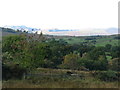
The country above Thackthwaite
The profile of Blencathra is seen on the left in the far distance. It is easy to see how it gained its alternative name of Saddleback.
Image: © David Purchase
Taken: 9 Oct 2013
0.09 miles
2
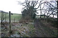
Footpath to Low Birchclose
Muddy and rarely used.
Image: © Bob Jenkins
Taken: 4 Jan 2006
0.13 miles
3
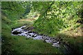
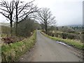
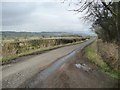
Minor road east of Thackthwaite Gill
The road is heading to the east having crossed Thackthwaite Gill at a hairpin bend just south of the small settlement of Thackthwaite itself.
Image: © Trevor Littlewood
Taken: 30 Mar 2018
0.14 miles
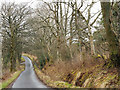
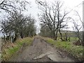
4
The road to Nabend
Descending to cross Thackthwaite Gill.
Image: © Christine Johnstone
Taken: 10 Mar 2017
0.15 miles
5
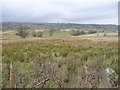
Farmland east of Thackthwaite
Looking north.
Image: © Christine Johnstone
Taken: 10 Mar 2017
0.16 miles
6
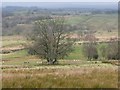
Tree with multiple trunks, east of Thackthwaite
On a field boundary between sheep pasture and more marshy land.
Image: © Christine Johnstone
Taken: 10 Mar 2017
0.16 miles
7
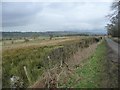
Marshy farmland at Thackthwaite
On the north side of the road to Dacre. About 275 metres above sea level.
Image: © Christine Johnstone
Taken: 10 Mar 2017
0.18 miles
8
The road to Lanehead and Dacre
Looking east.
Image: © Christine Johnstone
Taken: 10 Mar 2017
0.19 miles
9
The road skirting the east side of Little Mell Fell
Looking south. Classed as an 'other route with public access'.
Image: © Christine Johnstone
Taken: 10 Mar 2017
0.20 miles